
GREEK ISLANDS
(RHODES-HERKLION-PATMOS-SENTORINI-MYKONOS)

GENERAL INFORMATION-The Greek Islands comprise more than 6,000 islands and islets covering much of the eastern Mediterranean, and spreading in two main seas, the Aegean and the Ionian Sea. Only about 230 Greek islands are inhabited and of these just 80 or so have more than 100 permanent inhabitants. Each island group has its own flavor and each island within a group has its own character.The Greek islands are traditionally grouped into six major clusters:-
i-Cyclades- Cyclades are found in the central and southern area of the Aegean Sea and is composed of 39 islands of which 24 are inhabited. This group include the popular holiday islands of Mykonos and Santorini. The Cyclades are 'typical' Greek islands of whitewashed cube houses on windy, rocky outcrops. It is said that the Cyclades are the ferry hub of the Greek islands and so are a favourite for both island hopping holidays and for holiday yacht flotillas. The Cyclades have islands for all tastes - from the spectacular volcanic scenery of Santorini to the jet-set beauty spots on Mykonos. Mykonos and Santorini have the only international airports and many tourists fly in here to begin their Greek island hopping holidays.
ii-Dodecanese- Dodecanese Islands is the name given to the group of islands that hug the Turkish coast from Rhodes in the south to Patmos in the north. Dodecanese means 'twelve' and there are 12 major islands that give the group the name but in fact the Dodecanese consists of 163 islands in total, of which 26 are inhabited. Many of the Dodecanese islands have suffered turbulent histories at the hands of various invaders, notably the Turks and there is a strong Ottoman influence everywhere. The premier holiday island in this chain is Rhodes, the capital of the archipelago and by far the biggest island in the group with good air and sea links. Rhodes and Kos both have international airports and both ferries and hydrofoils ply a regular route through the Dodecanese. Apart from Rhodes the main package holiday island is Kos, with Kalymnos, Patmos and Leros popular with independent travellers. Most of the other islands, such as Halki, Symi, Lipsi, Pserimos, Tilos and Nisyros, are popular day trip destinations. The Dodecanese, close to the Turkish mainland, are the hottest, particularly in the south.
iii-Ionian- Found off the north-west coast of mainland Greece in the Ionian Sea. The Ionian, for example is characterised by lush greenery. The Ionian Islands are is one of the most popular holiday destinations in Greece. There are about 25 islands in this group but only a handful are of interest to the average holidaymaker. Corfu, Kefalonia, Zante. The prevailing historical influence is from the West - the Venetians, French and British. Today, the tourists are mostly British and Italian.
iv-North Aegean- A loose island group of 12 islands, to the north-east of Greece. The main holiday destinations here are Thassos, Lesvos and Samos.
v-Saronic- The Saronic Islands are found in the Saronic Gulf just to the south of the Greek capital of Athens. The main islands in this group are Aegina, Agistri, Poros, Methana and Salamis. The main inhabited islands of the Saronic group are Salamis (the famous site where the ancient Greek navy defeated the Persians), Aegina, Angistri, and Poros. Salamis, despite its romantic history is now an industrial suburb of Piraeus and it has a couple of beaches, has few foreign tourists.
vi-Sporades- A small, tightly-knit island group of 11 islands, just off the east coast of Greece that include Skiathos and Skopelos. Most holiday visitors arrive through Skiathos airport and Skiathos is a major holiday destination.
Some of the oldest European civilizations developed on the Greek islands (Cycladic, Minoan civilizations, etc.), so the islands have unique archaeological sites, a distinctive architectural heritage and the fascinating local traditions of a centuries-old and multifaceted civilization. Many of these Greek beaches have been awarded the blue flag under the Blue Flags of Europe Program, providing not only swimming, but also scuba diving, snorkelling, water skiing, sailing and windsurfing.
RHODES ISLAND (GREECE)
GENERAL INFORMATION - Today, it is one of the most popular tourist destinations in Europe located in Aegean Sea. Rhodes (Ro-dos) is the largest of the Dodecanese Islands in terms of land area. It is about 80kms long and 38kms wide covering an area of 1398Km2 and with a coastline of 220kms long. Its landscape mainly comprises of hills and low mountains, which in their majority are covered with forests. Olive trees, vines and other fruit producing trees are cultivated all over the island. Total population of the island is 1, 20,000. It is located northeast of Crete, southeast of Athens and just off the Anatolian coast of Turkey. It is 18kms from Turkey and 363kms from Greece mainland. Historically, Rhodes was famous worldwide for the Colossus of Rhodes, one of the Seven Wonders of the Ancient World. The Medieval Old Town of the City of Rhodes has been declared a World Heritage Site. The road network radiates from the city along the east and west coasts. The main air gateway (Diagoras International Airport) is located 14 km to the southwest of the city in Paradisi and near the resort of Kremasti. The most popular beaches are found on the north and east coasts. North coast beaches are not particularly good but they are closest to Rhodes Town and are home to mega-size hotel complexes.
HISTORY- Rhodes has been important since ancient times. The ancient city of Rhodes, the construction of which began in 407 BC, was designed according to the city planning system devised by the greatest city planner of antiquity, Hippodamus of Miletus. Rhodes soon developed into one of the most important seafaring and trading centres in the Eastern Mediterranean. When it became a province of the Roman, and later the Byzantine Empire, it initially lost its ancient glory. But in 1309 the Knights of Saint John of Jerusalem conquered Rhodes. They built strong fortifications to protect the island, turning it into an important administrative centre and a thriving multinational medieval city. In 1523 Rhodes was conquered by the Ottoman Turks and the Greeks had to settle outside the city walls. During the Ottoman occupation, new buildings were erected within the Old Town, mainly mosques and baths. In 1912 Rhodes and the rest of the Dodecanese, were seized by the Italians. The new rulers embellished the city with magnificent buildings, wide roads and squares. The Palace of the Grand Master was rebuilt and the Street of the Knights was reconstructed in order to regain its medieval purity. It was not until 1948 that Rhodes officially became part of Greece. In 1988 the Medieval City of Rhodes was listed as a UNESCO World Heritage site.
TEMPERATURE- Rhodes is graced with an exceptional Mediterranean climate, mild winters and sunny cool summers thanks to its sea breeze and the west winds. The island has sunshine during most of the year. As it is said: “There is hardly a day without sun”. The sunlight makes the island’s wine exquisite and gives the Ibiscus (flower-symbol of Rhodes) their special, vivid red colour.
Jan Feb Mar Apr May Jun Jul Aug Sep Oct Nov Dec
Av.M 15 15 17 20 24 28 30 31 28 24 20 17
Av.L 9 9 10 13 16 20 22 23 20 17 13 10
Av.M 15 15 17 20 24 28 30 31 28 24 20 17
Av.L 9 9 10 13 16 20 22 23 20 17 13 10
i- RHODES-OLD TOWN - The Old Town continues today to be divided into the two parts which made it up in the time of the Knights, the northern part, which was the internal fortress of the Knights, known as the Castello and which contained the official buildings and the larger southern part, called the Chora, where the Greeks and the Europeans who were not members of the Order and the Jews lived. These two parts of the town were separated by a wall running approximately parallel to the line of Sokratous Street, the old Bazaar. During the years of Turkish occupation, the Greeks were expelled from the Old Town, which was the exclusive province of Turks and Jews. Greeks were allowed to enter only during daytime and those who were caught in the old town after dark were liable to be beheaded. There are roughly 200 streets or lanes that simply have no name. Getting lost here is not a defeat, it's normal. If lost, you can ask for Sokratous, which is the closest the Old Town of Rhodes comes to having a main street. There are many gates to enter in the walled city. When one enters the city, it soon becomes obvious that the Old Town of Rhodes is a mosaic of different cultures and civilizations. The fascinating medieval fortress-like buildings, the bastions, walls, gates, narrow alleys, minarets, old houses, fountains, tranquil and busy squares make it feel like you have stepped back into medieval times. (Get the Map of the Town from the Information Centre when coming out of the Cruise)
ii-NEW CITY- Outside the walls of the Old Town lies the “new” city, with its magnificent Venetian, neoclassic and modern buildings. Among the most remarkable buildings that keep the memories of the island's Italian period alive are the Post Office, the Prefecture of the Dodecanese, formerly the Italian Governor's Palace that resembles the Doge's Palace in Venice, Evangelismos Church (Church of the Annunciation), the Town Hall and the National Theatre. A stroll around Mandráki, the small marina with the Rhodian Deer Statues at its entrance and the surrounding windmills. Next to the Prefecture stands the Murat Reis Mosque with its elegant minaret. Enjoy the sun and the sea at cosmopolitan Elli beach at the northern tip of Rhodes town, which is lined with modern hotels. Here you will also find the beautifully renovated historic Grande Albergo delle Rose, which today operates as a Casino. Saint Stefanos Hill (known as Monte Smith) marks the site of the Acropolis, one of the most important centres of worship, education and recreation in ancient times on Rhodes. At the top of the hill you will find the remains of the Temple of Apollo, a Hellenistic stadium and a gymnasium.
ii-NEW CITY- Outside the walls of the Old Town lies the “new” city, with its magnificent Venetian, neoclassic and modern buildings. Among the most remarkable buildings that keep the memories of the island's Italian period alive are the Post Office, the Prefecture of the Dodecanese, formerly the Italian Governor's Palace that resembles the Doge's Palace in Venice, Evangelismos Church (Church of the Annunciation), the Town Hall and the National Theatre. A stroll around Mandráki, the small marina with the Rhodian Deer Statues at its entrance and the surrounding windmills. Next to the Prefecture stands the Murat Reis Mosque with its elegant minaret. Enjoy the sun and the sea at cosmopolitan Elli beach at the northern tip of Rhodes town, which is lined with modern hotels. Here you will also find the beautifully renovated historic Grande Albergo delle Rose, which today operates as a Casino. Saint Stefanos Hill (known as Monte Smith) marks the site of the Acropolis, one of the most important centres of worship, education and recreation in ancient times on Rhodes. At the top of the hill you will find the remains of the Temple of Apollo, a Hellenistic stadium and a gymnasium.
SHORE EXCURTIONS WHEN COMING BY A CRUISE-
TOUR-01- Acropolis of Lindos & the Citadel of the Knights-Lindos is situated 55 km (40 miles) from the city of Rhodes and “bears” above it the Acropolis of Lindos, with the ancient Temple of Athena, built in 300 B.C. Here and there you will come across the captains’ mansions, built between the 16th and 18th century. In the centre of the village lives and breathes the Church of the Virgin Mary (Panagia) of Lindos, with frescoes from the 15th century. Ascend to the Acropolis of Lindos, here lies the Temple of Athena, of Doric order, which was erected on the location of an older monument. The ancient city-state of Lindos was for many centuries the most important on the island. It reached its heyday in the 6th century B.C.
Citadel of Knights- Back to the city of Rhodes where you will stroll through the Street of the Knights, all the way up to the Palace of the Grand Master. At the old city of Rhodes you will go through D’Amboise Gate to walk on the Street of the Knights. Along this street you will find the residences of the Knights, separated according to Order, which bear until today their corresponding crests. Duration is 6hrs.Ticket=74USD.
TOUR-02- Philerimos Church & Palace of The Knights-The Acropolis of ancient Rhodes stands proudly on the hill of St. Stephanos, also called Monte Smith. You will wander through the ruins of the Hellenistic Temple of Apollo, with its amazing columns. Further below, the restored Ancient Stadium of Diagoras once hosted games in honour of the sun god Helios. The next destination is Philerimos, to the northwest, one of the great touristic attractions of the island. The hill of Philerimos, above the homonymous bay, once "hosted" ancient Ialyssos, one of the three Rhodian cities that participated in the Trojan War. Stone steps surrounded by cypresses lead to the Gothic Monastery of Our Lady of Philerimos, dedicated to the Virgin Mary (the Life Giving Source). In the area you will also visit the Byzantine Church of St. George Hostos, with rare frescoes from the 14th-15th century which depict knights. Here also resides the "Golgotha", a path of 12 copper reliefs which depict the Passion of Christ. Back to the city of Rhodes where you will stroll through the Street of the Knights, all the way up to the Palace of the Grand Master. Duration is 4hrs.Ticket=74USD.
ATTRACTIONS AND SIGHTS AT RHODES-

INSIDE THE CITY WALL-
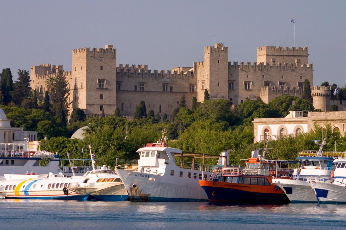
001-PALACE OF THE GRAND MASTERS- It was first built by the Knights of St. John that ruled the island from 1309 to 1522, on the site of a 7th century Byzantine fortress. The fortress was used as the residence of the head of the order, the Grand Master. It was rebuilt in the 1930s.The Knights of St. John were a Christian military organization founded to protect the Holy Land after a European army captured Jerusalem from Muslim forces in 1099, during the First Crusade. Following the fall of Jerusalem to the Muslim Seljuk Turks in 1187, the order moved its headquarters to Rhodes. The Turks captured the island in 1522, forcing the Knights to move to Malta. During the Ottoman occupation (from 1522 to 1912) the building was used as a prison. In 1865 some parts of the palace were damaged by an ammunition explosion. In 1912 the Italian occupation of the island, extensive restoration works were carried out between 1937 to 1940, in a grandiose manner, with a lavish interior, intending it as a holiday home for Mussolini and King Emmanuel III. On 10 February 1947, the Treaty of Peace with Italy, one of the Paris Peace Treaties, determined that the recently established Italian Republic would transfer the Dodecanese Islands to Greece. In 1948, Rhodes and the rest of the Dodecanese were transferred as previously agreed.
What is visible today as the Palace of the Grand Masters is the complete Italian reconstruction result. The exterior of the Palace of the Grand Masters is a faithful reproduction of the original, but the interior was built more to accommodate modern inhabitants than for accuracy to the original plans. Nevertheless it is worth a visit to appreciate the majestic medieval lifestyle of the Knights, and for the collection of authentic antique furniture and ancient floor mosaics the Italians assembled to decorate the various rooms. The two exhibitions of the history of Rhodes through Ancient Greek, Roman, and Byzantine times at the basement and ground floor of the palace should not be missed. Ticket=€6. An around €10 inclusive ticket covers the Palace of the Grand Masters, the Archaeological Museum and the Museum of the Decorative Arts.
Address: Street of the Knights/Ipoton Street, Medieval City.

002-AVENUE OF KNIGHTS (Ipoton Street) - Ipoton Street (Avenue of the Knights) was the place of residence of the knights and it is perfectly preserved to this day. It is about 600m long on a gentle incline towards and used to be the ancient acropolis of Rhodes, and it is unusually straight for a medieval street. The tall walls that frame it on both sides - complete with stone-carved codes of arms - are majestic and forbidding at the same time, and the old Knight’s inns are now replaced by several government offices. What is visible today is the result of the careful Italian restorations in 1913-16, and provide an accurate depiction of the original medieval street.
They were divided into seven ‘tongues’ or languages, according to their place of origin – England, France, Germany, Italy, Aragon, Auvergne and Provence and each was responsible for protecting a section of the bastion. The Grand Master, who was in charge, lived in the palace. To this day the street exudes a noble, forbidding aura.
First on the right, if you begin at the eastern end of the Avenue of the Knights, is the 1519 Inn of the Order of the Tongue of Italy. Next door is the Palace of Villiers de l’sle Adam. Next along is the Inn of France, the most ornate and distinctive of all the inns. Further along is the Chapelle Française, embellished with a statue of the Virgin and Child. Next door is the residence of the Chaplain of the Tongue of France. Across the alleyway is the Inn of Provence and opposite is the Inn of Spain. Near the end of the avenue, St John of the Collachio was originally a knights’ church with an underground passage linking it to the palace across the road.

003-ARCHAEOLOGICAL MUSEUM- The Archaeological Museum Housed in the old 15th-century Knights' hospital. The Hospital of the Knights was built in 1440 and completed by the Grand Master d’Aubusson in 1489, which exhibits archaeological finding from different parts of Rhodes and the surrounding islands. In the main courtyard sits a lion, of Lardos stone, its forepaws resting on the head of a bull. On the ground floor there are displays of ordnance from the Ottomans and Knights periods, as well as other finds. The masterpiece of the museum is Aphrodite of Rhodes, a small alabaster statue of the first century BC, depicting the goddess naked out of the bath, on one knee and raising its long hair, other famous grave stele of Kalliarista, the "Drunken Dionysus" and a headless statue of Artemis are just some of its exhibits.
Ticket=€6 .A around €10 inclusive ticket covers the Palace of the Grand Masters, the Archaeological Museum and the Museum of the Decorative Arts.
Address: Street of the Knights, Medieval City.
Ticket=€6 .A around €10 inclusive ticket covers the Palace of the Grand Masters, the Archaeological Museum and the Museum of the Decorative Arts.
Address: Street of the Knights, Medieval City.
004- THE DECORATIVE ARTS COLLECTION-The Decorative Arts Collection includes objects from the Ethnographic Collection of the Italians, the Folklore Archives of the Dodecanese with donations, seizure and excavations of the Archaeological Service Dodecanese, reflecting the elegance of the inhabitants of the island in modern times. The collection includes costumes, embroidery, woodwork, metalwork and pottery objects. Among them are the specimens of pottery of Nice (16th-19th centuries), Armenian dishes from the Kutahya houses, jugs with decorations of monstrous figures, local pottery samples from the villages of Rhodes, plus 19th and 20th century European Origin ceramics, woodcuts and other objects.
Ticket Price: Ticket=€2 .A around €10 inclusive ticket covers the Palace of the Grand Masters, the Archaeological Museum and the Museum of the Decorative Arts.
Address: Argyrokastrou Square- Medieval City.(near the Pili Eleftherias Gate/Liberty Gate) .
Ticket Price: Ticket=€2 .A around €10 inclusive ticket covers the Palace of the Grand Masters, the Archaeological Museum and the Museum of the Decorative Arts.
Address: Argyrokastrou Square- Medieval City.(near the Pili Eleftherias Gate/Liberty Gate) .

005-THE MUSEUM OF MODERN GREEK ART- Includes collections of paintings and engravings representing Greek art from the 20th century’s distinguished artists, numerous sculptures, drawings and documents. These collections describe the history of Greece over the last hundred years. Housed in four buildings.
Ticket: 3 euro. Note: With one ticket of 3 euro one can visit all the four buildings of the Museum of Modern Greek Art.
Address: Sokratous Street, Medieval City.
Ticket: 3 euro. Note: With one ticket of 3 euro one can visit all the four buildings of the Museum of Modern Greek Art.
Address: Sokratous Street, Medieval City.

006-GATE OF FREDOM/LIBERTY (Pili Eleftherias) - The Gate was opened in 1924 by the Italians, who looked on themselves as liberators of the island from the Turks. It is the entry point when coming from Mandraki Harbour or from St. Nicolas Tower.It opens in Simi Square also known as Arsenal Square. Other gate St. Paul Gate is near to this gate.

007- RHODES CITY WALL- The city walls of Rhodes were built in many stages over two centuries, partly on top of the Byzantine fortifications. Work on the walls began before 1330 and were completed sometime in 1522. The wall is as massive as it is beautiful. It is a continuous, 4 km. long, stone construction that supports a walking platform from which defenders could move and fight where needed. Massive towers project from several place and they are decorated with elaborate stonework, while a wide dry Moat provided the first line of defence.

008-TEMPLE OF APHRODITE-The Temple of Aphrodite is located on Symi Square in front of the Eleftherias Gate in Rhodes. It dates from the third century BC. Today the ruins recall the former glory of the ancient temple dedicated to the god Aphrodite.

009- HPPOKRATOUS SQUARE – Hppokratous Square lies in the medieval walled city of Rhodes. In the centre of the square stands an ornamental fountain- Castellania Fountain, which, along with a grand staircase from the south west section, is the only remaining evidence of the Castellania, an important building constructed by the Knights Hospitaller in the 14th century. When you enter the Old City by the Marine Gate, you will find yourself in Hppokratous Square, which is a great place to begin exploring the UNESCO World Heritage Site. All around, coffee shops and restaurants burst at the seams as they spill onto the street having completely covered the old buildings.
The Palace Of Castellan-It is a square building restored by the Italians and its exterior staircase is a popular spot where people relax to watch the square activity in front of them. Castellinia was originally built in 1507 and was the Knight’s commercial court before the Turks converted it to a fish market, with a mosque on the floor above.
The Palace Of Castellan-It is a square building restored by the Italians and its exterior staircase is a popular spot where people relax to watch the square activity in front of them. Castellinia was originally built in 1507 and was the Knight’s commercial court before the Turks converted it to a fish market, with a mosque on the floor above.

010- SQUARE OF JEWISH MARTYRS-The Square of Jewish Martyrs is also called Sea Horse Square, because there is a charming sea horse fountain located here. The square's Holocaust Memorial pays tribute to the 1,604 Jews of Rhodes that were sent to die at Auschwitz. Only 151 Jews survived the Holocaust. Today there are only about 35 Jews living .

011-CHURCH OF THE VIRGIN OF THE BURGH (Pangia tou Bourgou)-The Church of the Virgin of the Burgh lies at the eastern edge of the Rhodes Old City, in the Jewish Quarter. The 14th century construction is one of the oldest remaining buildings from the era of the Knights of Hospitaller during medieval times. Its grand, original Gothic style remains impressive, even though it sadly suffered damage from bombing during World War II. Only three of the church’s apses have survived unharmed and, despite the heavy damage.

012-MOSQUE OF SULEYMAN - During Turkish times, churches were converted to mosques, and many more Muslim houses of worship were built from scratch, although most are now dilapidated, the most important of which is the colourful, pink-domed Mosque of Süleyman , at the top of Sokratous Street. Currently closed to the public, it was built in 1522 to commemorate the Ottoman victory against the Knights, on the site of the destroyed Christian Church of the Apostles. It was renovated in 1808. Opposite is the 18th-century Muslim Library, founded in 1794. Continuing through the winding pedestrian streets will bring you to the municipal Hammam Turkish Baths.
Address- Sokratous Street.
Address- Sokratous Street.

013-KAHAL SHALOM SYNAGOGUE & JEWISH QUARTER-Built in 1577, Kahal Shalom Synagogue is Greece’s oldest synagogue and the only one surviving on Rhodes. The Jewish quarter, in the 1920s, had a population of 4000. Exhibits include early 20th-century photos, intricately decorated documents and displays about the 1673 Jews deported from Rhodes to Auschwitz in 1944 during Nazi occupation. Only 151 survived. Jews still worship here and it is usually open in the morning. The synagogue is currently located on Dossiadou and Simiou Streets.

OUTSIDE CITY WALLS-
014- THE COLOSSUS OF RHODES- The Colossus of Rhodes was a statue of the Greek Titan-god of the sun Helios. It is considered one of the Seven Wonders of the Ancient World. The Colossus of Rhodes stood over 30 metres (98 feet) high, making it one of the tallest statues of the ancient world. Its history begins with the siege of Demetrios Poliorketes, successor of Alexander the Great, in 305 BC. When Demetrios was defeated, he abandoned all his siege machinery on Rhodes. The Rhodians decided to express their pride by building a triumphal statue of their favourite god, Helios. The task was assigned to the sculptor Chares of Lindos, and took twelve years (from 304 to 292 BC) to complete it. It was a symbol of unity of the people who inhabited that beautiful Mediterranean Island of Rhodes. The base was made of white marble. When the Colossus was finished, it stood about 33 metres (110 feet) high. The statue was constructed of bronze plates over an iron framework. A strong earthquake hit Rhodes at around 226 BC. The city was badly damaged, and the Colossus was broken down at its weakest point - the knee.
From its building to its destruction, the statue stands a time span of merely 56 years. For almost a millennium, the statue lay broken in ruins. In AD 654, the Arabs invaded Rhodes. They disassembled the remains of the broken Colossus and sold them to a Jew from Syria. It is said that the fragments had to be transported to Syria on the backs of 900 camels.

015- RHODIAN DEER STATUES- Mandraki is one of the three harbours and it is the oldest one in Rhodes. It is famous, because it is believed that the great statue of Colossus, one of the Seven Wonders of the Ancient World, once stood at the harbour entrance. Today the two deer sculptures at the entrance on the two sides of the harbour on the top of elegant columns are very elegantly placed. The significance of the deer is as follows- in classical times Rhodes island was said to be overrun with snakes, many of them poisonous. The non-indigenous deer were introduced to the island to combat the reptiles. Today, there is still a small colony of Rhodian deer residing in a protected environment within Rhodini Park. Today these two charming Rhodian deer sculptures serve as the guardians of the harbour.

016-ST. NICHOLAS FORTRESS- The imposing St. Nicholas Fortress is located in the Rhodes Old City looking out over Mandraki Harbour. In ancient times Mandraki Harbour was a military space and in the 15th century a guard tower was constructed. Following the first siege, the tower was fortified. A bastion was added by Grand Master d’Aubusson and the newly formed fortress was named after the chapel inside it. It was largely thanks to the fortress that the Knights Hospitaller were able to fend off attacks from the Turks for so many years. Major sieges by the Turks were mounted in 1480 and 1522-23. The initial attack was thwarted, but the Turks ended up seizing power in 1522 and the Knights were forced to leave Rhodes to Malta. When the fortress was built, it took into account the Ottoman use of cannons and other siege weaponry and its thick walls were impermeable for many years. Indeed considering their age, they are in excellent condition to this day. The fortress is hugely popular with visitors these days and it has been well preserved. You can walk along the path of the former moat, which has been dried out and provides a scenic, tree lined walking path.

017-MEDIEVAL WINDMILLS AT MANDREKI- The Windmills of Mandraki are located on the wave breaker of Mandraki Harbour in Rhodes. These medieval windmills were used to ground the grain that came from the commercial ships docking in the harbour. It is believed that there were once 13 or 14 windmills, but most of them have disintegrated over time. Three of these beautiful structures have been renovated and stand as majestic reminders of times past.

018-EVANGELISMOS CHURCH-Evangelismos Church (also called The Church of the Annunciation) is located next to Mandraki Harbour. It was built in 1925 by the Italians, as Rhodes was an Italian city at that time. The church is a magnificent example of Gothic architecture. It is similar in design to St. John Church located in Old Town. This church is also dedicated to St. John.

019-MAIN POST OFFICE-The Main Post Office in Rhodes is a stunning building located in Liberty Square (Plateia Eleftherias). It may not be one of the oldest constructions on the island, but its impressive Renaissance architectural style is beautiful and worthwhile visiting. The Main Post Office was built during the first years of the Italian reign over the island, between 1912 and 1943. It has always maintained its function as the principal post office on the island, initially, under the Italian and, more recently, under the Greek postal service. The façade is highly stylized and features impressive carvings and engravings into the local porous stone. Above the grand entrance there is an emblem of the god of sun and there are entrances to either side. The Main Post Office, constructed during Italian sovereignty, were deliberately opulent in order to emphasize the superiority of the Italian reign, as well as to attract tourists to the new part of the city of Rhodes. The Main Post Office is open daily between 8:30am and 2:30pm.

020-NEW MARKET HALL-New Market Hall is located opposite Mandraki Harbour. It is a long, white building with a magnificent entrance. The ground floor of the market houses a number of cafes and bars, and there are an array of taverns, shops and cafes located in the open area. Tourists like shopping at this market, as there are a lot of jewellery and gift shops here.

021-LIGHTHOUSE OF ST. NICHOLAS FORTRESS-The Lighthouse is located at the St. Nicholas Fortress in Mandraki Harbour. It dates back to 1863, during the Ottoman period. The Lighthouse was reactivated in 2007. It is a round, unpainted, white stone tower that displays two white flashes every twelve seconds, lighting the way for incoming ships.

022-SOUND & LIGHT SHOW-In the Municipal Garden that surround the walls of the Medieval town takes place an entertaining and educational show. Combining the dramatic architectural setting with lighting, projected images and stereophonic effects, this show is a kind of theatre without actors. It narrates the story of the unequal struggles between the Knights of Saint John and the people of Rhodes against the might of the Turkish Army under the leadership of Suleiman the Great (1522 AD). Some of the great monuments of the Medieval town of Rhodes play a leading role in a drama, based on historic sources, as each is bathed successively in coloured light. The show is given in five different languages and lasts about 50 minutes. Ticket =7Euro
023-GOVERNER PALACE- It is one of the most considerable buildings constructed during the Italian occupation of the island. It is a combination of many different architectural styles and its arrangement strongly resembles the Palace of the Duces in Venice. It was built in 1927. It was used by the Ialians as the Governor's Palace and today it houses the Prefecture of the Dodecanese.

024-THE AQUARIUM OF RHODES- Located on the Northern tip of the island it was built by the Italians in 1934. In 1937 it began working as a research unit called the Royal Institute of Marine Biology of Rhodes.
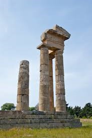
025-ACROPOLIS OF RHODES-The Acropolis of Rhodes is an acropolis dating from the Classical Greek period (5th–3rd century BC) 3 kilometres from the centre of Rhodes. The partially reconstructed part of the site consists of the "Temple of Apollo” below which is a stadium and a small theatre. It is included in a large park.

026- ACROPOLIS OF LINDOS -Lindos is one of the most impressive archaeological site on Rhodes. To get to the Acropolis follow the road that leads up to the hill. It has Byzantine architecture on the outside, with 2nd-century-BC Doric architecture inside, this beautifully preserved Acropolis and is worth the climb up the 116m-high rock. See the 20-columned Hellenistic stoa (200 BC) and the Byzantine Church of Agios Ioannis, with its ancient frescoes, to the right. The wide stairway behind the stoa leads to a 5th-century-BC propylaeum, beyond which is the 4th-century Temple to Athena. Athena was worshipped at Lindos as early as the 10th century BC, this temple has replaced earlier ones on the site. Donkey rides to the Acropolis cost €5 one way. There’s no shade at the top so pack a hat and some water. At the foot of the acropolis lies the traditional village of Líndos with its cubic whitewashed houses, mansions, Byzantine churches and narrow cobbled streets.

027-TSAMBIKA BEACH-Tsambika Beach is an 800 meters long beach of fine pure sand, gently shelving on the east coast of the island of Rhodes. Distance is about 26 km from the capital, this pure-sand beach has survived from permanent development as most of the land is owned by the Orthodox Church. It has crystal clear waters and it’s considered ideal for families with children as it is all sandy and shallow. There are umbrellas and loungers, water sports and a few canteens for sandwiches, ice cream and refreshments.

028-MONOLITHOS CASTLE-The Monolithos Castle is the mediaeval castle, which stands among the pines on the great outcrop of an isolated rock from which the name Monolithos (lonely rock) is derived. After Leaving the car at the bottom, there is a ten-minute walk that will bring you to the top, an alternative is to ride a donkey to the top , the station is by the main square for about €5, where you will see view of the sea and the fragrance of the wild herbs. Within the castle walls stands the church of Agios Panteleimon including the inner Temple of Athena Lindia at the highest seaward point on the rock. The remains seen today – columns of the propylaia and inner bemas (raised platforms) – date from 342BC. Bellow the castle you will find an attractive stone building housing a small café. The road leads on to Fourni, the beach at Monolithos, ideal for those who like pebbles, waves and a peaceful setting.

029-RED TRAIN-Enjoy a fabulous sightseeing in Rhodes with the Municipal Road Train. A Tour of Rhodes city along the fortifications of the Medieval City, the Temple of Apollo, the Ancient Stadium and the New Town Center.
Departure: from café Aktaion-Marina Mandraki
Daily itineraries: High season: every hour between 10:00 and 17:00
Ticket - 6 euro
Duration of the Trip: 45 minutes
Departure: from café Aktaion-Marina Mandraki
Daily itineraries: High season: every hour between 10:00 and 17:00
Ticket - 6 euro
Duration of the Trip: 45 minutes
HERAKLION (GREECE)

GENERAL INFORMATION-Heraklion (or Heraklio) is the largest city in Crete, located roughly in the centre of the north coast. Heraklion has a population of 131,000 (2001). It is also the capital of Crete and one of the Mediterranean region's most fascinating and vibrant and mediaeval city. Heraklion is the 4th largest city in Greece. Cretan cuisine, based on olive oil, vegetables, fruits, legumes grains and wine, is popular all over the world for its health and taste. It has the largest port and airport in Crete. Heraklion Airport is also known as “Nikos Kazantzakis” International Airport, in honour of the most famous Cretan writer worldwide.
Heraklion Airport is 5 kilometres east of the city, in the Nea Alikarnassos area. Flight companies offering domestic flights into and out of Heraklion Airport are Olympic Airways, Aegean Airways and Sky Express.
There are also daily ferry routes to and from Heraklion Port, connecting it to the port of Piraeus, Santorini and other islands in the Cyclades. Large, modern Minoan Lines and ANEK ships cross to Piraeus, while you can travel to Santorini and the Cyclades by very fast catamaran. Heraklion Port is also visited by many cruise ships all year round.
HISTORY-Crete was the centre of the Minoan civilization, a sophisticated Bronze Age culture from 2600-1150 B.C. The island bears witness to their achievements in the form of palaces, tombs and sacred sites. This civilization was so sophisticated that they even had a large navy.
The Minoans were affected significantly by tsunami waves from the eruption of a huge volcano in Santorini, Greece in 1450 B.C. Towards the end of the Late Bronze Age, the Minoans were superseded by Mycenaeans from the Greek mainland. Thereafter, Crete very much followed in the classical mainstream of Greece and - much later - Rome.
Crete was invaded by Romans from 69-330 A.C. and this period of time plus the Byzantine era actually brought much wealth to the Island. The beauty and wealth of this time can still be seen today by mosaics and monuments around the island.
Crete history is very much related to famous myths like when the King of Crete, Minos, refused to sacrifice a bull to the Greek gods. Poseidon in turn forced Minos's wife to fall in love with a bull which created the mythical beast, the Minotaur.
During the First Byzantine period (4th-9th AD), the small town of Heraklion was known as Katsro (Castle), indicating that there was some sort of fortification. Crete was a province of the Byzantine Empire, whose capital was Constantinople. A band of Saracen Arabs led by Abu Hafs Omar were driven first from Spain and then from Alexandria. Taking advantage of the weak defenses of Crete, they conquered the island in 824-828 AD. Piracy was their main occupation, so they choose Heraklion as the capital of their emirate. Its position in north central Crete lent itself to their raids on the Aegean coasts on the one hand, and to the collection of agricultural produce from the whole island for trading with Islamic states on the other.
Heraklion was fortified with brick walls set on stone foundations, surrounded by a deep ditch or dry moat (khandaq). The Byzantines regarded Crete and its capital, Chandax, under Arab rule as a nest of pirates and slavers. In 961 AD, Nicephorus Phocas, commander-in-chief and later emperor of Byzantium, succeeded in reconquering Crete and the Second Byzantine period began. The Fourth Crusade in 1204 resulted in the fall of Constantinople and the Byzantine Empire to the Crusaders. Crete finally passed into Venetian hands in 1211. Their rule was to last until 1669, with Crete forming a single administrative province known as the Kingdom of Crete. From the very beginning of their rule, the Venetians attempted to consolidate their grip on the island by introducing elements of their metropolis Venice, to their new colony. This is most obvious in the architecture, with both the public buildings of Heraklion (Ducal Palace, Loggia, Basilica of St Mark) and private residences presenting distinctive Renaissance elements and a sense of grandeur. Most of the monuments still standing in Heraklion today date to this period.
In 1645 began the fifth Veneto-Turkish war. A Turkish army landed in west Crete in that year. The siege of Chandax (Heraklion) began in 1647 and lasted for 22 years, until 1669, when the city finally fell to the Turks. The strongest fortress of the Eastern Mediterranean had withstood the longest siege in history. In December 1913 the union of Crete with Greece was officially proclaimed. Crete was now an inseparable part of the Greek state, sharing its adventures and its future. The Asia Minor Catastrophe of 1922 led to the exchange of populations between Greece and Turkey. A million Greeks from Asia Minor (the west coast of Turkey) and East Thrace came to Greece, while half a million Muslims left the country.
TEMPERTURE-
JAN FEB MAR APR MAY JUN JUL AUG SEP OCT NOV DEC
AvH 15 15 17 20 23 28 29 28 26 23 20 17
Av L 10 10 11 13 16 20 23 23 21 17 15 12
JAN FEB MAR APR MAY JUN JUL AUG SEP OCT NOV DEC
AvH 15 15 17 20 23 28 29 28 26 23 20 17
Av L 10 10 11 13 16 20 23 23 21 17 15 12

CRETE ISLAND- It is the largest of the Greek islands, and fifth in size among the islands of the Mediterranean, after Sicily, Sardinia, Corsica and Cyprus. Its coasts are washed by the waters of the Cretan Sea on the northern side, by the Libyan Sea on the southern side, by the Karpathian Sea on the eastern side, and on the west by the Myrtoon Sea. The island is 260kms long and 60-12kms wide with area of 8261km2 .Crete’s natural beauty is equalled only by the richness of its history. The island is the birthplace of the first advanced society on European soil, the Minoans, who ruled over much of the Aegean some 4000 years ago, not miss a visit to the Minoan Palaces of Knossos. Located at the crossroads of three continents (Europe-Asia-Africa), Crete has been coveted and occupied by consecutive invaders, throughout its history.
MINOAN CIVILISATION- The Minoan civilization flourished in the middle Bronze Age on the Mediterranean Island of Crete from 2000 BC until 1500 BC and, with their unique art and architecture, the Minoans made a significant contribution to the development of Western European civilization as it is known today. Minoan settlements, tombs and cemeteries have been found all over Crete and the four principal palace sites (in order of size) were at Knossos, Phaistos, Malia and Zakros. At each of these sites, large, complex palace structures of two or three stories and covering several thousand square metres seem to have acted as local administrative centre. The palaces covered two different periods. The first were constructed around 2000 BC and following destructive earthquakes and fires, re-built again in 1700 BC. These second palaces survived until their final destruction between 1500 BC and 1450 BC, once again by either earthquake, fire or any other reason. The sophistication of the Minoan culture and its trading capacity is evidenced by the presence of writing, predominantly found on various types of administrative clay tablets. Magnificent frescoes from the walls and floors of the palaces also reveal the Minoans’ love of the sea and nature and give insights into religious practices.
SAINT MINAS- Saint Minas or Menas was born in Egypt in the mid-3rd century AD to idolatrous parents, but became a Christian in adolescence. When he came of age, he decided to follow a career in the Roman army and served as a cavalry officer in Asia Minor. In 303 AD began the great persecution of the Christians under the Emperors Diocletian and Maximian, which lasted until 311 AD. Roman soldiers were ordered to arrest and torture Christians to renounce their faith. St Minas, true to his faith, resigned from the Roman army and lived as a hermit in the mountains. When he was about 50 years of age, a divine vision revealed that the time had come for him to suffer martyrdom. He left the safety of the mountains and went down to the city, where he declared his faith before the idolaters. He was arrested, imprisoned and horribly tortured. He was whipped, flayed and dragged naked along a road of sharp stones. Despite his horrific martyrdom, the saint refused to renounce his faith and was eventually beheaded. Saint Minas was declared the patron saint of Heraklion during the Turkish period. St Minas has been depicted as a Roman general on horseback and honoured as the patron saint of Heraklion. Minas was considered the protector of the city by not only the Christians but also the Turks, who regarded him with fear and respect.
SHORE EXCURTIONS WHEN COMING BY A CRUISE-
Tour-01-Minoan Palace of Knossos - The ancient city of Knossos. The palace of Knossos spreads around the large Central Court. You will reach the awe inspiring Throne Room, the fresco of the "Prince of the Lilies", the imposing Grand Staircase, the Queen's Megaron in the east. Walking through the apartments of the Knossos palace and observing the finds even as passers-by, you will feel part of this cultural heritage. Price=66USD, Duration-3.5hrs.
Tour-02-Experience the Cretan Country-It is characteristic, that the island of Crete has the most traditional vineyards of the whole of Europe. Grapes have been cultivated here since the Minoan era, a tradition spanning 4,000 years. So undoubtedly the Cretans are hearty connoisseurs when it comes to wine. In fact, 70% of the production of Cretan wine comes from the "Peza" valley. This will also be the first stop of your excursion. Next follows Vathypetro, a small Minoan palace with exterior courtyards of ashlar masonry, with storage facilities and porticoes, which was discovered in 1949 by Spyros Marinatos. Passing through villages and vineyards, you reach Archanes, an important Minoan settlement, built at the foot of Mount Juktas. Here you will have the time to try the Cretan delicacies, taste the local wine and take in the local music at the area’s central square, under the generous shade of the trees. Price=66USD, Duration-3.5hrs.
Tour-02-Experience the Cretan Country-It is characteristic, that the island of Crete has the most traditional vineyards of the whole of Europe. Grapes have been cultivated here since the Minoan era, a tradition spanning 4,000 years. So undoubtedly the Cretans are hearty connoisseurs when it comes to wine. In fact, 70% of the production of Cretan wine comes from the "Peza" valley. This will also be the first stop of your excursion. Next follows Vathypetro, a small Minoan palace with exterior courtyards of ashlar masonry, with storage facilities and porticoes, which was discovered in 1949 by Spyros Marinatos. Passing through villages and vineyards, you reach Archanes, an important Minoan settlement, built at the foot of Mount Juktas. Here you will have the time to try the Cretan delicacies, taste the local wine and take in the local music at the area’s central square, under the generous shade of the trees. Price=66USD, Duration-3.5hrs.
ATTRACTIONS & SIGHTS-

001- HERAKLION HARBOUR- The Venetian Harbour of Heraklion is at the end of 25th of August Street, the pedestrian street leading from the town centre to the Koules fortress. This is the old harbour of Heraklion, now used by fishing boats and yachts, and its history is as ancient as that of the city itself. The new, modern passenger and cargo Heraklion port extends east of the old harbour. Here begins the long mole of the new harbour. The mole is a favourite spot for a stroll, especially on warm summer evenings, when the sea breeze offers some relief from the heat. The Venetian harbour also contains the Venetian Arsenals or shipyards, where ships were repaired.

002- KOULES- The Venetian fortress is at the entrance to the harbour, symbol of the city of Heraklion and it dominates the entrance. The fortress was originally built by the Venetians and called Rocca al Mare, but is now known by its Turkish name, Koules. It has a mixed history; for centuries it was used as protection against invaders, as were the great city walls and ditches. These are among the longest city walls in Europe. With its huge dark hallways and cells, the fortress was also a prison to many Cretan rebels and those who broke the rules imposed by successive occupiers of Crete. Koules is built on two tiers and offers a commanding view of Heraklion from the battlements. In the mid-15th century it was found that Heraklion is inadequately fortified and the harbour tower the Byzantine Castellum Comunis, was weak and useless for purposes of defence. In 1462 the Venetian Senate approved an ambitious programme of fortification of the city, which was to defend both Heraklion and the burgs (suburbs) outside it. As part of this project, the harbour tower was demolished in 1523 and replaced by the Koules fortress still standing today. The natural rocky outcrop at this point of the harbour was banked up extensively to form the platform on which the fortress was to be built, covering an area of 3,600 m2.The work was carried out in a very interesting way, old ships were filled with stone from the island of Dia and sunk off the north side of the mole, forming a breakwater and increasing the space available. The outer walls are almost 9 metres thick, while the inner walls are up to 3 metres thick at some points. There were three entrances to the fortress, on the west, north and southwest sides, the main gate was on the west. Various plaques, inscriptions and coats of arms carved in relief were set into the outer walls. The best are the three marble reliefs depicting the winged lion of St Mark, the symbol of the Most Serene Republic of Venice, one over each entrance. You can visit Koules from 08:30 to 15:00 in the winter and 19:00 in the summer, every day except Mondays. Nowadays, the harbour itself is home to brightly.

003-25TH OF AUGUST STREET WALK- The car free 25 August St. is directly opposite the Old Harbour and extends to Lion Square. It takes its name from a massacre of ‘martyrs' which occurred in 1898. This involved the killing of many Cretans and, crucially, British in this area, by the Turks, finally forcing the ‘Great Powers' (Britain, France and Russia) to recognize Crete's struggle. These events led eventually to the declaration of a Cretan State and, finally, unification with Greece in 1913. Old and modern buildings compete for space now on the street named to remember 25th August.
It has always been the main thoroughfare of Heraklion, linking the town Centre to the harbour. 25th of August Street is now a paved pedestrian street, and boasts the most beautiful Neoclassical buildings in Heraklion. Today they house banks, travel bureaux and tourist shops. These buildings were erected after the catastrophe of 1898, to give Heraklion the air of a modern city. The street was ironically known as "Odos Planis" ("Illusion Street"). 25th of August Street runs from the Meidani, the central crossroads of Heraklion, down to the Venetian Harbour and the fortress of Koules. Walking up the short hill, and passing the shops and tourist offices, we reach St. Titus' Cathedral, an impressive sight. A little further and you discover the Venetian architecture of the Loggia which functioned as a club for the nobility to gather and relax. St. Mark's Basilica, almost next door, is now the Municipal Art Gallery. Next is the Lion square which is the heart of Heraklion where tourists and locals meets.
It has always been the main thoroughfare of Heraklion, linking the town Centre to the harbour. 25th of August Street is now a paved pedestrian street, and boasts the most beautiful Neoclassical buildings in Heraklion. Today they house banks, travel bureaux and tourist shops. These buildings were erected after the catastrophe of 1898, to give Heraklion the air of a modern city. The street was ironically known as "Odos Planis" ("Illusion Street"). 25th of August Street runs from the Meidani, the central crossroads of Heraklion, down to the Venetian Harbour and the fortress of Koules. Walking up the short hill, and passing the shops and tourist offices, we reach St. Titus' Cathedral, an impressive sight. A little further and you discover the Venetian architecture of the Loggia which functioned as a club for the nobility to gather and relax. St. Mark's Basilica, almost next door, is now the Municipal Art Gallery. Next is the Lion square which is the heart of Heraklion where tourists and locals meets.

004- CHURCH OF SAINT TITUS-Saint Titus was a disciple of the Apostle Paul and the first Bishop of Crete. It was built in 961AD, when Arabs were driven away from the Crete, bringing the island back under the wing of the powerful Byzantine Empire. At the fall of Heraklion to the Turks all relics were removed to Venice, where they still remain today. The single exception is the skull of St Titus, which was returned to Heraklion in 1966 and is now kept in a silver reliquary in the church. During the period of Turkish rule, the church of Saint Titus was ceded to Vizier Fazil Ahmet Kiopruli, who converted it into a mosque known as the Vezir Mosque. The great earthquake of 1856 totally destroyed the church. It was rebuilt in its present form as an Ottoman Mosque. The minaret of Saint Titus was demolished in the 1920s, when the last Muslims left Heraklion with the exchange of populations between Greece and Turkey. Today Saint Titus is an Orthodox church dedicated to St Titus the Apostle, following modifications carried out by the Church of Crete in 1925.

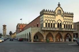
005- VENETIAN LOGGIA (Nobles Club)-It is the most elegant Venetian monument in Heraklion, located on 25th of August Street, a few yards downhill from the Basilica of St Mark and the Lions. The elegant building of the Loggia is one of the finest monuments of Venetian Crete. The Loggia was constructed in 1626-28 by Francesco Morosini, the same man who built the Lions Fountain (Fontana Morosini) in Eleftheriou Venizelou Square, which is very near to this building. The Loggia was a rectangular two-storey building, with an open arcade on the ground floor. The building has semi-circular arches, decorated with trophies and coats of arms. It is a masterly combination of two different architectural styles, the Doric style on the ground floor and the Ionic on the upper floor. The building is a faithful reproduction of Palladio’s famous Basilica in Vincenza, demonstrating the significance the Venetians attached to the city of Heraklion. Today the Loggia has been restored to its former glory and houses the Town Hall.

006- BASILICA OF ST MARK- The Basilica of Saint Mark is one of the most important Venetian monuments in Heraklion.The Basilica of Saint Mark is directly opposite the Lions Fountain, in Eleftheriou Venizelou Square in the centre of Heraklion. Today it houses the Municipal Art Gallery. Built in 1239 in the Piazza delle Biade (Square of Blades), it was at one time the Cathedral of Crete. The Basilica belonged to the reigning Duke, eventually becoming his burial place.

007- LIONS SQUARE/Liondaria Square (Eleftheriou Venizelou Square) - It is one of the busiest parts of Heraklion. This is where travellers who arrive in Heraklion by ferry at dawn come for a bougatsa cream pie or visit an exhibition in the Basilica of St Mark.Historical sources tell us that during the period of Arab rule (9th-10th century AD), the square was the largest slave market in the Eastern Mediterranean. During the Byzantine period (10th-13th century), the Lions Square was the site of the residence of the Byzantine governor of Heraklion. In Venetian times (13th-17th century), this was where the Palace of the Venetian Duke of Crete (the Palazzo Ducale) stood, where the Duke and his two councillors (Consiglieri) decided the fate of Heraklion and its people. Venetian times the Lions Square was known as the Piazza delle Biade, or Grain Square. The Piazza delle Biade was the main square of Heraklion and is thought to have been modelled on St Mark’s Square in Venice. The Ducal Palace was a two-storey building with verandas and vaulted areas on the ground floor which were rented out as shops. It was on the north side of the Lions Square, where the souvlaki shops are today, taking up a whole block. After the Turkish conquest of the island, the Vizier and his retinue established themselves in the Ducal Palace. The Voltone Gate stood next to the Lions Square, at the Meidani crossroads.

008-THE MOROSINI FOUNTAIN-The Fontana Morosini, the famous fountain of the lions. The fountain was constructed not for aesthetic purposes but to bring unlimited drinking water to thirsty Heraklion. Heraklion had no springs and its inhabitants used wells and rainwater cisterns. The work took 14 months to complete and the fountain was inaugurated on 25 April 1628, the feast day of St Mark, the patron saint of Venice. The water reaches from Archanes on Mt Juktas to Heraklion along a 15-kilometre-long aqueduct. The basin of the fountain stands on a circular base and is composed of eight lobes, making it easier for many people to fill their water-jars simultaneously. About five people could dip their jars in the fountain at each lobe. The lobes of the fountain are decorated with scenes from Greek mythology carved in relief, mainly Tritons, dolphins and nymphs, mythical water beings. At the centre of each lobe were the coats of arms of the Doge, the Duke, the Councillors and Morosini himself.At the centre of the fountain, on a high octagonal pedestal, sit four proud lions with water flowing from their mouths. The lion is not an animal usually found on fountains, it was used as the symbol of Venetian power. At its foundations lies the underground reservoir for the water. Due to the difference in altitude between Archanes and Heraklion, the water flowed down naturally to the underground reservoir under the fountain.

009- DAIDALOU STREET -The commercial pedestrian street in the heart of Heraklion. Daidalou Street is named after Daedalus, the ingenious craftsman and symbol of scientific and technological know-how in Minoan myth. Daidalou Street is in the centre of Heraklion, starting from the side of the Astoria Hotel, on the northwest side of Eleftherias Square. The whole street is a paved pedestrian area lined with offices, shops and tourist shops. The street leads to the Morsini Fountain from Lions Square (Eleftheriou Venizelou Square) and along it you will find the largest concentration of music shops in Heraklion. During the German invasion much of the centre of Heraklion was destroyed in the bombing, so the modern image of Daidalou Street dates from the post-war period.

010- ELEFTHERIAS SQUARE/FREEDOM SQUARE-The spacious Plateia Eleftherias is worth exploring, built in a crescent shape alongside the Archaeological Museum and close to Heraklion's municipal buildings and the main foreign Consulates. Apart from breathing space, it offers the shaded park of Georgiades, a fine place to rest the feet and watch the busiest intersection in Heraklion.
It is the main square of Heraklion. It was the free space during Venetian times where mercenary army used as a training ground. At the turn of the 20th century, the square was the inhabitants’ main recreation area. Eleftherias Square was the focal point of people’s Sunday stroll. The square, retaining some of its eucalyptus trees, was paved with marble, acquired minimalist benches and was decorated with metal pylons symbolising ships’ masts, reminiscent of the city’s maritime history. Today Eleftherias Square, with its public services, Archaeological Museum and cafeterias. It is a favourite rendezvous point for older people, although the younger crowd prefer the Lions Square and the cafés in Korai and Milatou Streets. In the centre of Eleftherias Square stands the statue of the Unknown Soldier, a 20th-century work. On national days (25 March and 28 October) and on the anniversary of the Battle of Crete, the Heraklion authorities lay wreaths there in honour of those who gave their lives for liberty.
It is the main square of Heraklion. It was the free space during Venetian times where mercenary army used as a training ground. At the turn of the 20th century, the square was the inhabitants’ main recreation area. Eleftherias Square was the focal point of people’s Sunday stroll. The square, retaining some of its eucalyptus trees, was paved with marble, acquired minimalist benches and was decorated with metal pylons symbolising ships’ masts, reminiscent of the city’s maritime history. Today Eleftherias Square, with its public services, Archaeological Museum and cafeterias. It is a favourite rendezvous point for older people, although the younger crowd prefer the Lions Square and the cafés in Korai and Milatou Streets. In the centre of Eleftherias Square stands the statue of the Unknown Soldier, a 20th-century work. On national days (25 March and 28 October) and on the anniversary of the Battle of Crete, the Heraklion authorities lay wreaths there in honour of those who gave their lives for liberty.

011- ARCHAEOLOGICAL MUSEUM OF HERAKLION-It is located on the eastern side of Eleftherias Square is the Heraklion Archaeological Museum near Tourist Office. The world famous Heraklion Archaeological Museum was built between 1937 and 1940 on a site that had been occupied during the Venetian Period by an imposing Catholic monastery of St. Francis, which was destroyed by the earthquake of 1856. The Minoan civilisation, is the first in Europe, is revived through the exhibits allowing visitors to admire it in its full historical sequence. This is one of the most important museums in Europe and the only one in the world to house the treasures of the Minoan civilisation. The 20 room’s house finds from the Neolithic to the Roman period, on the ground floor of the museum there are 13 rooms open to the public while on the 1st floor fragments of the original frescos from the Minoan Palace of Knossos are exhibited. All exhibits in the Heraklion Museum come exclusively from archaeological sites in Crete. As soon as the visitors start their tour in the Heraklion Museum they can see the evolution of pottery from the Neolithic period (5000-2500 BC) until the Post-Palace Period (1400- 1100 BC). Finally, the frescos in the upper floor show in the best way Minoan's love for nature and the joy of life. The subjects of the frescos are taken from everyday life or, more often, from nature. Their colours still remain vibrant and indelible. Summer-Monday: 13.00-19.30 .Tuesday-Friday: 08.00-19.30.
Adress-Stefanou Xanthoudidou Street 1, Heraklion.
Adress-Stefanou Xanthoudidou Street 1, Heraklion.

012- HISTORICAL MUSEUM OF CRETE - Founded in 1953 by the Society of Cretan Historical Studies (S.C.H.S.), the Historical Museum of Crete (H.M.C.) presents a comprehensive view of Cretan history from early Christian times to the present day. The original goal of those founding the Historical Museum of Crete was to collect and preserve valuable archaeological, ethnographic and historical material deriving from the medieval and modern periods in Cretan history.Located on Leof. Sofokli Venizelou.1km from Platia 18 Agioon.

013- COAST ROAD- West of Koules runs the western coast road of Heraklion, Sofokli Venizelou Avenue. Right on the sea wall is a pedestrian area with a wonderful view of the sea, where you can enjoy a pleasant stroll. Continuing west along the coast road, on your left you will see the ruins of the monastery basilica of the Dominican order, the church of Peter and Paul. When it was built in the 13th century, during the Venetian period, it was one of the most important churches of Heraklion. The coast road continues west to the Pancretan Olympic Stadium, a 28,000-seater sports stadium built for the 2004 Olympics. New nightclubs and cafeterias are constantly opening along the coast road, forming a major part of the Heraklion nightlife scene. Approximately 700 meters west of the natural History Museum is the Talos Shopping Centre, with shops, cafés and a multiplex cinema.
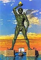
014- SAINT MINAS CATHEDRAL-The cathedral dedicated to the patron saint of Heraklion. To go to the Cathedral of Saint Minas, walk along Vikela Street and then Agiou Mina Street, a five-to-ten-minute walk at most. The original church of Saint Minas, was built in 1735 and housed the Metropolis of Crete for the first time after the Turkish occupation. In front of the Cathedral of Saint Minas is a large paved square. To the right is the Archiepiscopate of Crete, while to the left is the original little church of Saint Minas. Next to Saint Minas is the church of Agia Ekaterini (St Catherine of Sinai) and Saint Catherine Square. The foundations of the imposing cathedral of Saint Minas, one of the largest in Greece, were laid on 25 March 1862 as a token of gratitude by the citizens for the saint's protection of the city. The site is said to have been indicated by a monk to whom St Minas appeared in a vision. The cathedral was inaugurated with great pomp in 1895, although in Turkish rule.
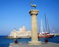
015- CITY WALL-Heraklion is surrounded by a formidable medieval wall, which was used to protect it from enemies. Owing to this, the city enjoyed the reputation as a well-fortified state in the Mediterranean basin. The first fortifications were built by the Arabs and were later reinforced by the Venetians (15th century). From the seven bastions, only the Martinengo bastion survives to this day .It stood up to a siege from the Turks for 21 years, but was finally seized in 1669 after its betrayal by a Greek-Venetian engineer who informed the invaders of the walls' weaknesses at east and west bastions. It is possible now to walk along the top of these walls and enjoy a view over the city. You may reach the Grave of the Cretan writer Nikos Kazantzakis (1883-1957), where it is written: "I hope for nothing, I fear nothing; I am free"
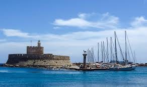
016- AMOUDARA-It is a very long, sandy beach with clean water. The organized coast and the close distance from Heraklion Town makes it very popular. It is 5kms from Heraklion Town. Amoudara with its 5 km long sandy beach is one of the most popular resorts near Heraklion city. The holiday center of Amoudara bustles with life during summertime as hundreds of tourists choose to spend their vacation in that area of Heraklion. Its long sandy beach, awarded with the European Blue Flag is ideal not only for sunbathing and swimming, but also for all kinds of water sports. In Ammoudara visitors will find everything they need: traditional taverns, serving delicious dishes, cafes, shops, jewellery stores, bars and nightclubs for a fabulous nightlife.

017-KNOSSOS- Five km south of Heraklion lies Knossos, one of the most important archeological sites in Europe, the legendary Centre of the Minoan civilization from 1900 to 1400 BC. The Palace of Knossos, the largest one in Minoan Crete, witnessed two architectural phases and which was devastated by the earthquake of Santorini (1450 BC). The site contains the remains of the palace of Minos, of dwellings occupied by officials, priests and residents, as well as of cemeteries. The Palace was an intricate building complex built around a central court. It was laid out on a surface of 22,000 m2 and apart from the royal apartments, it encompass the site itself includes the Palace of Knossos, The Minoan Houses, the Little Palace, the Royal Villa, with famous Roman mosaics, the south Royal Temple – Tomb and the Caravanserai.
PATMOS (PATMOS ISLAND-GREECE)

GENERAL INFROMATION- The island of Patmos is one of the Greek islands of the Aegean Sea and it belongs to the Dodecanese islands group. The most important element of Patmos is certainly its spirituality, as the Cave of the Apocalypse and the Monastery of Saint John the Theologian. Famous for its religious past, the island is where Saint John wrote the Book of Revelation. Also known as the "Jerusalem of the Aegean", Patmos was formally declared a Holy Island in 1983 by the Greek government. Of course Patmos has the privilege of being one of the few places in the world that someone can feel the presence of Divinity so strongly and that is precisely what most of the visitors are looking for. For many years now, Patmos has been an island of pilgrimage for Catholic and Orthodox faithful who come to the island to absorb the spiritual heritage and bask in its beauty and serenity. Today, this mountainous island with small coves also attracts various sun lovers, wanting to swim in the crystalline waters. The island of Patmos has an area of 34 sq. kilometres. With an approximate population of 3000 persons, Patmos lies between the islands of Leros, Fourni and Ikaria. The islands has 63km of coastline offers a wide selection of beaches, from sandy and organized shores with umbrellas and beach bars to solitary coves. There is a full supermarket (Nazoe Supermarket) for all needs at the port of Patmos, Skala, near the new Marina. Going to Monastry you will first land at Skala.
DEVELOPMENT OF CHRISTENDOM (MONASTERY & CAVE) – Patmos had been used as a place of exile by the Romans on account of its steep morphology. That’s how St. John found safe refuge here in the 1st century A.D., exiled by the Emperor Domitian. The Book of Revelation was written in 95 A.D. in the Holy Cave of the Apolacypse, where St. John heard the voice of God talking to him.
The founder of the Monastery of Patmos Island was Saint John the Theologian, he was born in Nice of Bithynia in Asia Minor in 1020AD and his name was originally John. He was quickly drawn to a solitary life and lived as a hermit on Mount Olympus in Bithynia and renamed himself Christodoulos ("slave of Christ" in Greek). Later he travelled to many places such as Rome, Palestine and North Africa. During the reign of Arabic influence, Patmos Island was almost a deserted island. In 1088 Christodoulos requested the emperor and was granted possession of all the island by the Byzantine Emperor Alexius I Comnenos to establish a Monastery in honour of Saint John the Evangelist and to transform the Cave of the Apocalypse into a sacred place. Christodoulos stayed on Patmos Island until Arab pirate raids forced him to leave the island in 1118. But his vision continued to inspire enlightened monks who continued his work in the next centuries. The Foundation of the Monastery of Saint John the Theologian and also of the Monastery of the Apocalypse marked the genesis of a cultural, spiritual and religious centre which is a reference point for the whole Christian world. The entire complex of the Monastery is a rare example of monastic, fortified architecture which is unique in the world and was formed mainly from the Middle Ages up till today along with Chora of Patmos. The Monastery of Patmos Island as well as the Cave of the Apocalypse is a significant site of pilgrimage for Christianity with an immense global appeal. Christodoulos fled to Euboea in Greece where he died in 1093. His relics were transferred later to the Monastery of Patmos Island. Christodoulos by his life and work inspired commendable monks who gave the Holy Monastery of Patmos Island its current Global attraction. A celebration in his honour is held on 21st October and on 16th March.
The founder of the Monastery of Patmos Island was Saint John the Theologian, he was born in Nice of Bithynia in Asia Minor in 1020AD and his name was originally John. He was quickly drawn to a solitary life and lived as a hermit on Mount Olympus in Bithynia and renamed himself Christodoulos ("slave of Christ" in Greek). Later he travelled to many places such as Rome, Palestine and North Africa. During the reign of Arabic influence, Patmos Island was almost a deserted island. In 1088 Christodoulos requested the emperor and was granted possession of all the island by the Byzantine Emperor Alexius I Comnenos to establish a Monastery in honour of Saint John the Evangelist and to transform the Cave of the Apocalypse into a sacred place. Christodoulos stayed on Patmos Island until Arab pirate raids forced him to leave the island in 1118. But his vision continued to inspire enlightened monks who continued his work in the next centuries. The Foundation of the Monastery of Saint John the Theologian and also of the Monastery of the Apocalypse marked the genesis of a cultural, spiritual and religious centre which is a reference point for the whole Christian world. The entire complex of the Monastery is a rare example of monastic, fortified architecture which is unique in the world and was formed mainly from the Middle Ages up till today along with Chora of Patmos. The Monastery of Patmos Island as well as the Cave of the Apocalypse is a significant site of pilgrimage for Christianity with an immense global appeal. Christodoulos fled to Euboea in Greece where he died in 1093. His relics were transferred later to the Monastery of Patmos Island. Christodoulos by his life and work inspired commendable monks who gave the Holy Monastery of Patmos Island its current Global attraction. A celebration in his honour is held on 21st October and on 16th March.
PATMOS SHORE EXCURTIONS –
Tour-01- St. John's Monastery & Grotto of the Apocalypse-The picturesque alleyways wind upwards, towards the Monastery of St. John the Evangelist, founded in 1088 by St. Christodoulos. Next stop, the small museum which hosts religious treasures of inestimable value, like manuscripts, medieval textiles, sacerdotal vestments and others. Price=61USD, Duration-2hrs.
Tour-02- Patmos Countryside Tour with Hora and Grotto-The panoramic excursion begins at the port of Scala heading towards the centre of the island, to Chora. At the main town you will visit the Grotto of the Apocalypse and at the top of the “castle” behind the walls, you will see the Monastery of St. John the Evangelist, of Byzantine architecture. The silent windmills in Chora have witnessed important events on the island which attracts thousands of tourists. The tour of the island continues towards more desolate landscapes, which are the trademark of the Dodecanese. Rocky hills, barren, dry soil. After this enlightening excursion through the island, the tour will conclude at Scala, the port, where the atmospherical café “Arion”, the oldest and most picturesque of the area, will be waiting for you for coffee, refreshments or juice. Price=59USD, Duration-2hrs.
SIGHTS & ATTRACTIONS AT PATMOS-


001-PATMOS TOWN (CHORA OR HORA) - Chora is the capital of Patmos and can be found 3km to the southwest of Skala. The most picturesque village is Chora, with white houses, paved paths and great view to the Aegean Sea. Built around the imposing fortified Monastery of Saint John during the 12 century, the town came to prominence during the 16 Century when beautiful mansions houses and captain residences were built, testifying to the wealth of the people of Patmos. These can be seen alongside the traditional architecture of lovely whitewashed houses on narrow streets and alleyways with flourishing courtyards. There is a donkey track going from Skala and to walk up to Chora, which can be hard work on a hot summer’s day ,walking in Hora during a sunny mid-day is not recommended, the whitewashed houses reflect the sunlight making it tiring and straining for the eyes and skin. The afternoon and morning sunlight really give the alleyways a more Byzantine aura and a night walk is considered very romantic. It starts about 1 kilometre in from the port, and takes about 25 minutes to walk up to Hora. It is recommend you take a bus or taxi up and walk your way down the donkey track through the pine forest to the cave of the Revelation and then to Skala. Otherwise it's a 4.5km drive on asphalt road lined with eucalyptus trees and pine forests.


002-MONASTERY OF ST. JOHN THE THEOLOGIAN -It is located on the high hill above Chora (the village of Patmos Island) and is visible from every part of the island. The Holy Monastery of Patmos was founded by Holy Christodoulos. The Monastery is built on top of the mountain and dominates not only the Chora of Patmos Island which is built around it today but the entire island. Archaeological findings indicate that it was built on a site of an ancient temple dedicated to the Goddess Artemis, while in the same place there was also an early Christian Church (Basilica). The Monastery is surrounded by an irregular, rectangular defensive arcade which dates from the end of the 11th up till the 17th century.
As you enter the gate you come to the main courtyard inlaid with local pebbles and stones. The eastern side is dominated by an arch with four curves and many frescoes representing the miracles performed by Saint John. In total, the monastery houses ten chapels, and the most impressive part of the monastery is the main chapel with a beautiful wood-carved icon stand, marble floor and rich decoration. The Library, established by St Christodoulos, is of extreme interest, it includes 2,000 volumes, 13,000 historic documents and 900 manuscripts. There is also a museum, located next to the bakery. It houses an amazing collection of icons, original manuscripts, sacred relics, vestments embroiled with silver or gold threads and bejewelled with precious stones to list a few. (Open Mon-Sat, 8am-1.30pm; Tue and Thurs, also 4pm-6pm; Sun, 10am-1pm and 4pm-6pm; admission free.)
As you enter the gate you come to the main courtyard inlaid with local pebbles and stones. The eastern side is dominated by an arch with four curves and many frescoes representing the miracles performed by Saint John. In total, the monastery houses ten chapels, and the most impressive part of the monastery is the main chapel with a beautiful wood-carved icon stand, marble floor and rich decoration. The Library, established by St Christodoulos, is of extreme interest, it includes 2,000 volumes, 13,000 historic documents and 900 manuscripts. There is also a museum, located next to the bakery. It houses an amazing collection of icons, original manuscripts, sacred relics, vestments embroiled with silver or gold threads and bejewelled with precious stones to list a few. (Open Mon-Sat, 8am-1.30pm; Tue and Thurs, also 4pm-6pm; Sun, 10am-1pm and 4pm-6pm; admission free.)


003-CAVE OF THE APOCALYPSE-The Sacred Cave of the Apocalypse is situated on Patmos Island between the Port of Patmos, Skala and Chora, approximately in the middle of the route. St. John the Divine is said to have made his home in this cave and is said to be where he had his revelation and became known as the Book of the Apocalypse, or Revelation, the last book of the Christian Bible. The cave today is enclosed within a sanctuary. From the entrance of the buildings of the Apocalypse one descends several steps and first enters the integrated small temple located just beside the cave. To the right one can see the imposing site of the cave. There is a monk and/or spiritual leader that will guide you through the cave, although it is recommended to sit on one of the stools and absorb the energy of this miraculous cave that some believe is one of the great mysteries of the world. This sacred site inside the cave is a foundation of the Christian tradition, the rock is ragged with three small fissures which symbolize the Holy Trinity, and the voice of God was heard and dictated to Saint John the text of the Revelation. Afterwards he recited it to Prochorus his disciple and assistant who recorded it. Apart from other means of transportation you can visit the Cave of the Apocalypse on foot through the historic trail that connects Skala to Chora of Patmos Island.

004-ZOODOHOU PIGIS-A women's convent in Chora that was founded by the abbot of the monastery of St. John, in 1607. There are two churches, Zoodohou Pigis and St. John the theologian, both with icons dating from the 16th to the 18th century.

005-SKALA-The main harbour of Patmos, Skala is the most populated town on the island. Skala as is stands today started its development in the 19th century as prior to this it was susceptible to pirate raids. Houses started to be built and the area gradually became a business and shipping centre. Now with the growth of tourism, Skala is taking on the role of "the city of Patmos" offering the most in the way of public services, supermarkets, gift shops, restaurants, and evening entertainment. Among the many sights of Skala are the ruins of the ancient acropolis, the convent of Zoodochos Pigi, and the church of Panagia Koumana. Due to the port, Skala is the busiest spot of the island. Very nice beaches are located on the northern side of the island, such as Agriolivado and Livadi Geranou, which are also organized.
006- AGIOS THEOLOGOS (SAINT THEOLOGIAN) - About 200 meters from the port is the beginning of the beach. It is a sandy beach which is very popular on weekdays with the locals. There is a row of snack bars along the beach making it very convenient for tourist on cruise boats, or day trippers from nearby islands who don't have a lot of time. At the end of the beach there is fenced of section with a sign saying that this was the spot that Saint John baptized the first Christians on the island in approximately 95AD, apparently there is a spring that runs under the beach to the sea, making that section of the beach extra refreshing.

007- AGRIOLIVADI -This beach is approximately 1.5 km from Skala, it has a long sandy beach with small pebbles. Sun beds and water sports are available here. It also has a tavern and a beach bar. It is mainly shallow waters make it ideal for toddlers and the water is warmer than in most other beaches around the island.
There are some nice little coves to your left which are accessible only by boat so you can rent paddle boats and paddle there but only in good weather because the currents do get strong as soon as you reach the end of the cove.
There are some nice little coves to your left which are accessible only by boat so you can rent paddle boats and paddle there but only in good weather because the currents do get strong as soon as you reach the end of the cove.
SENTORINI ISLAND-GREECE
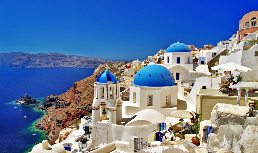
GENERAL INFORMATION-Santorini or Thira, is the top destination in Greece and among the most romantic destinations of the Greek islands and also in the world. Santorini Island is 76 sq. km. in area and has 69 km of coastline. Located in the Aegean Sea, in the Cyclades islands. Santorini Island was the site of one of the largest volcanic eruptions in the world and what remains today is a submerged volcano and a caldera (a very large circular hollow that remains when the central part of a volcano falls in after an eruption) therefore Santorini is the only inhabited Caldera (volcano cauldron) in the world. Unlike the other islands in Greece, the towns and villages sit densely on top of the massive cliffs of the Caldera and from a distance they appear like snow capping the towering mountain tops at 260m above sea. The coloured strata of the volcanic rock of these cliffs are spectacular in themselves- chocolate brown, rust red, yellow ochre, white and cream. The geological uniqueness however is not the only thing that makes Santorini a special holiday destination. Amazing villages has been constructed on the edge of this caldera, with Cycladic architecture and breath-taking view to the sea. Apart from the fabulous caldera villages, Santorini is also famous for the romantic sunset, the volcano and the luxurious resorts. Sunset are breathtakingly beautiful when seen as a backdrop to the volcano. From Oia (a small town), you will enjoy the most romantic sunset of your life, with the orange sun dipping into the sea. The colours that streak the sky change from lilac to deep purple, from yellow to orange to red, as the golden sun sinks and becomes blood red reflecting its light on to the sea and the surrounding little islands, an amazing scene for photography. The most marvellous point about the Santorini is its architecture of the villages, built right on the edge of the caldera. These picturesque villages distinguish for their sugar-cube houses, the paved streets and the wonderful churches and the breath-taking view to the Aegean Sea .Due to its special atmosphere, Santorini has become a popular wedding and honeymoon destination. It is a very touristy island and therefore rather expensive. The islands largest export product is soil, 2,000,000 tons a year are used all over the world, mainly to make concrete. The Suez channel was built with this concrete for example. The eastern slopes of the island are green and fertile. This is due to the copious vineyards that grow so well in the fertile volcanic soil. The terraced slopes of the mountains use every part of this fertile land. The island suffer from water scarcity, because it has few natural water reserves, but the nature of the dry soil of Santorini produces grapes that make up one of the best wines of Greece. The climate, though damp is healthy and perfect for producing the famous wine (vinsando), fava beans and tomatoes. Treat your taste buds to some famous traditional products like cherry tomatoes, white egg plants, fava, caper and “hloró tyrí”, a special kind of fresh goat cheese found on the island and try some of the wines - Assyrtiko, Athyri, Aidani, Mantilaria and Mavrotragano are just some of the distinctive varieties that you can taste at the island’s famous wineries or at restaurants. Today the island's economy relies on tourism, where tens of thousands tourists from Greece and around the world visit the island for unforgettable holidays. The harbour of Athinios where the small cruise ship stop is connected to Fira and the rest of the island by a well-made serpentine road and with a port for tender boats is Thira Port. The old port of Fira under the town is used only for passengers from the big cruise ships reaching through boats. You can also walk up or down that road (almost 900steps) or take a donkey ride all the way. There is also a cable car taking you straight to Fira.
HISTORY-According to searches and excavations on Santorini, it hosted an important civilization around 3600 BC near Akrotiri of a Minoan colony. Due to eruption everything was destroyed. Phoenicians settled on ancient Thera around 1,300 BC and around 1100 BC, the island was occupied by the Lacedaemonian. The Romans originally used the island as a place for exiles, but later helped in building up the island. The Christianization of Santorini took place between the 2nd and 5th century. Between 1200 AC and 1579 AC, the island was under Byzantine rule and the church of Episkopi Gonia is founded. The island was often ravaged and even destroyed by pirates and in 1204 it was conquered by the Venetians. It was about then the island got its current name. The islands patron saint was Agia Irini (St Eirene) and the foreign sailors called her St Irini - thus Santorini. During the Turkish rule (1579-1821) the island succeeds in trading development with the ports of Eastern Mediterranean. The tourist development in Santorini begins in the 1970s and today it is one of the best tourist destinations in the world.
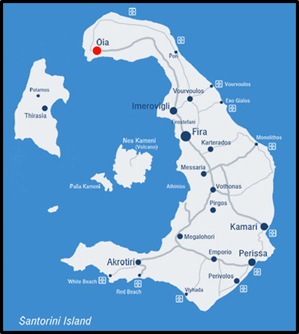
GEOGRAPHY-Its wild volcanic landscape. The island of Santorini was formed out of the lava from the volcanic eruptions. The central part of the volcano sank in earthquake, leading to the emergence of Santorini itself and the tiny neighbouring islands of Thirasia, Palaia and Nea Kameni. The solid material and gases emerging from the volcano’s interior created a huge “vacuum” underneath, causing the collapse of the central part and the creation of an enormous “pot” –today’s Caldera– with a size of 8x4 km and a depth of up to 400m below sea level. Santorini got its present half-moon shape in about 1,650 BC when a severe volcanic eruption took place, the round shape was disappeared. The intense volcanic eruption of 1,650 BC, covered in ashes the Minoan settlement of Akrotiri on the southern of the island and raised waves so high that reached the northern coasts of Crete and destroyed the Minoan towns and after that, the centre of Santorini sank and the many earthquakes that followed destroyed a big part of the rest of the island. Presently the half of Santorini caldera is submerged, which makes it the only sunken caldera in the world. The volcano of Santorini remains still active and along centuries many eruptions have occasionally occurred. The latest was as recently as 1956, when small volcanic islets emerged from the bottom of the caldera. In one of these eruptions, the islet Nea Kameni emerged, just opposite the caldera villages, known as the volcano to the locals. This volcano can be visited by boat excursion from the old port of Fira.
SANTORINI BEACHES-The beaches in Santorini are much different than other beaches in Greece due to their special geographical features. Red and black volcanic pebbles lay the shores of Santorini beaches and steep cliffs provide a picturesque ambience. The most famous of Santorini beaches is the Red Beach, while particularly popular are Perissa, Kamari and Perivolos.

A-FIRA SANTORINI -Fira is the capital of Santorini and the most important of all villages. It is located at the west side of the island and 10 km away from the main port, Athinios. Fira has 1,600 inhabitants. It is located on the edge of a cliff, at a height of 260 meters offering a great panoramic view over the submerged volcano. In 1956, the island of Santorini was hit by an earthquake that destroyed a large part of the island but luckily, some of the 18th century buildings were saved. The town of Fira is a typical Cycladic village made of charming white houses with blue windows and doors, separated from each other by small paved streets. Many of its beautiful buildings including some blue domed churches and sun-bathed verandas that offer an incredible view of the volcano and the sunset. Fira also has a port (now old port) that was, for many years, the main port of Santorini. Today, this port is only used for cruise boats. From there, boats can take visitors for a tour to the volcano of Nea and Palia Kameni. Some places are-
i-Plateia Theotokopoulou (Theotokopoulou Square) is the main square of Fira and it is where all the locals meet. The small streets during peak season period are crowed and filled with all kind of shops, jewelleries, cafe, restaurants, bars and night clubs.
ii- The main road of 25 Martiou (25th March) intersecting the square and is lined with travel agencies.
iii- Erythrou Stavrou, one block west of 25 Martiou, is the main commercial thoroughfare.
iv- Another block west, Ypapantis runs along the crest of the caldera and provides some staggering panoramic views.
v-Bus Stand (Lower Fira Town)- If arriving in Santorini's Thira town by public bus from the main port (far left), your terminus is the Square. Taxis cannot manoeuvre in the small streets overlooking the caldera or in most of Fira itself.
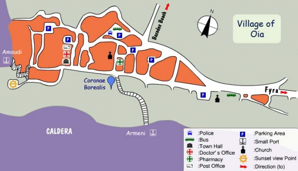
B-OIA SANTORINI-It is Oia, pronounced Ia, is the most famous of all villages of Santorini. It is known throughout the world for its quiet life and fantastic sunset and is certainly the most beautiful and picturesque village of Santorini. The village is also situated on top of an impressive cliff and offers a spectacular view over the volcano of Palia and Nea Kameni and the island of Thirassia. Oia is situated on the north of the island, 11 km away from Fira, therefore from the port it is about 22kms. Oia is much quieter that Fira and the busiest area is the main pedestrian that runs along its length. At the entrance of the village is a car park where visitors can leave their vehicle and enjoy long walks in the picturesque paths. Many artists fell in love with the area and settled there. For that reason, the village of Oia has many art galleries. Oia also has a small port, Ammoudi, which can be reached by a set of 300 steps leading down. There, small boats can take you opposite, to the island of Thirassia. The beach of Armenis is also located there.
SHORE EXCURTION-
Tour-01- Spectacular Oia Village Perched On The Caldera Rim-To the east, in the background, you will have settlements like Kamari and Monolithos, while you will pass through Fira, the small traditional villages of Firostefani and Imerovigli with delicate architecture and beauties, to eventually arrive at the settlement of Oia. During the entire route, to the west you will have before your eyes the lace-like caldera, the little islands of Thirasia, Palea and Nea Kameni . In Oia you will have plenty of time to stroll through the marble-paved alleys, to gaze at the adorably cute shops, to take pictures, to become acquainted with the characteristic buildings, carved into the rocks and the unusual captains' manors, the settlement Ammoudi at the foot of the caldera. After your curiosity has been satisfied of the area which is characterized as being of "exceptional natural beauty", your return begins. Duration is 3hrs.Ticket=72USD.
Tour-02- Cruise to Santorini's Islands and Volcanoes-From the cruise ship you will be transported easily within a few minutes by small boat to Nea Kameni which resembles a moon landscape. You will walk up to the verge of the crater, the heart of the volcano, a unique geological phenomenon which will overwhelm you with awe. In Nea Kameni nowadays there is gas-steam activity at the top of the crater, while its beaches are embraced by thermal springs. The next stop of this special excursion, is Palea (or Palia) Kameni with its therapeutically, warm waters. The sea temperature here is 5°C higher than in the rest of the locations and the green-yellow water contains sulphur. After the trip to the volcano, you will have the chance to walk, take keepsake photos, to touch the magic and energy of Fira. Finishing your trip in the main town of Santorini, you will descend by funicular (the ticket is included in the fee of this excursion) to the Old Port to reach the cruise ship by small boat.
ATTRACTIONS & SIGHTS AT SANTORINI-
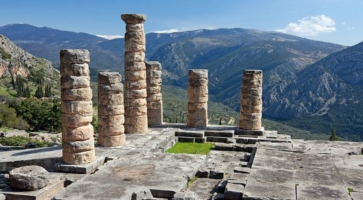
001-RED BEACH SANTORINI- The red beach is one of the most famous and beautiful beaches of Santorini. It is located some steps away from the ancient site of Akrotiri. The small size of the beach creates a much crowded atmosphere. This unique landscape of red and black volcanic rocks is very beautiful by different colours. Many sunbeds and umbrellas cover the dark sand and right on the seashore are some nice pebbles you can use for your collection. Snorkelling is highly recommended due to the interesting rocks. The beach can be reached either by boat (there are several connecting Red Beach with Perissa and Akrotiri or by foot (10 minutes’ walk from Akrotiri, you have to reach Agios Nikolaos church in Akrotiri next to the excavations area).You can also access the beach by boat that departs from Akrotiri port.
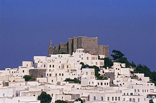
002-KAMARI SANTORINI-Kamari is a famous beach resort of Santorini situated 10 km southeast of Fira, the island's capital. The beach is covered by black sand while on the left side of the beach is an enormous rock called Mesa Vouno that rises from the sea. The area is extremely attractive, especially at night when the rock shines in the dark. The beach of Kamari is fully organised offering a wide range of facilities like sunbeds, umbrellas and various types of water sports. The traditional houses line the village of Kamari offering a beautiful view to the sea. Visitors can take a nice walk along the waterfront.

003- ARCHAEOLOGICAL MUSEUM AT FIRA - Near the cable-car station, which is at the other end of town between the cathedral and the bus station. This museum houses impressive finds from Akrotiri and Ancient Thira, along with some Cycladic figurines, and beautiful Hellenistic and Roman sculptures. Entrance Fee=3Euro.

004-THE MUSEUM OF PREHISTORIC THERA AT FIRA -The Museum of Prehistoric Thera, located in the island’s capital Fira, is not an ordinary provincial museum. Its special contents, masterpieces of art in the prehistoric Aegean, such as the famous wall-paintings and the unique gold ibex figurine, place it on a par with the Acropolis Museum of Classical Greece (Parthenon sculptures) and the Virginia Museum of Northern Greece.
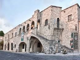
005-MEGARO GHYZI MUSEUM-This museum is just a few minutes uphill slightly from the Archaeological Museum and is housed in an old mansion owned by the Catholic diocese of Santorini which has been restored as a cultural centre. Here an excellent collection of old prints and maps but particularly interesting are photographs of the town before and after the 1956 earthquake. And newspaper cuttings from around the world relaying the drastic news. Entrance was 3 euro. Excellent copies of the prints of women in their various costumes from previous centuries can be purchased as well as an interesting array of books on the area.
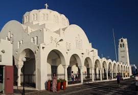
006-ORTHODOX METROPOLITAN CATHEDRAL-This Greek Orthodox Cathedral in Fira, which is situated on the cliff top at the bottom of the town, is a prominent land mark with a large square outside. The cathedral has beautiful frescoes inside which were painted by a local artist, Christoforos Assimis. This cathedral sits prominently and can be seen from quite a distance but up close

007- GIALOS-Gialos is the port below Fira (the old port of Santorini) with no car access. It is the famous donkey ride. In bad weather, ships dock immediately below the town of Fira at Skala Fira or Stair Fira. One may ascend the 587 steps (1000 ft.) by foot, donkey, mule, or cable-car (funicular).

008-ATHINIO PORT- The main port of the island of Santorini is also located in Fira at 8kms to the south. This port, called Athinio, is constantly receiving ferries and cruise ships. From Athinio Port Bus/Taxi takes 20-30 minutes to the bus stand of Fira. All vehicle climb up a very steep winding road to get anywhere from Athinios. If travel by cruise ship, that reaches two miles away from old port of the island.
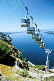
009-CABLE CAR FIRA- Cable Car was established in 1979 by the ship owner Evangelos Nomikos who gave all the expenses for the Cable Car purchase and installation. Cable cars depart every 15 minutes from 6:45 am to 8:15 pm and takes about 3 minutes to reach top at Fira. Ticket=3euro.
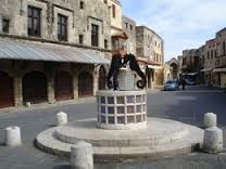
010-CATHEDRAL OF SAINT JOHN THE BAPTIST- The main Catholic church on Santorini is the Cathedral of Saint John the Baptist, located in Fira. The church is located near the main square and overlooks the ocean where many cruise ships and ferries come and go. The Catholic wedding service is held in St. John the Baptist's Cathedral.

011-FOLKLORE MUSEUM FIRA-The folklore museum of Santorini is located in Fira at a place called Kontohori. The museum is hosted into traditional cave houses of 1861. The museum displays workshops of carpenters, barrel makers, shoemakers and blacksmiths as well as an original old winery, a gallery with works of local current artists and document archives. Ticket=3euro.

012-WINDMILL VILLAS- The Windmill Villas is a complex of Santorinian windmills converted to fully furnished villas. Each with a kidney-shaped pool with hydro massage jets, the elegant villas are 800 metres from the beach. This Windmill Villas is on the east side of Santorini, between Fira and Oia. The port is 13 km away, while Santorini International Airport is reached at 12 km.
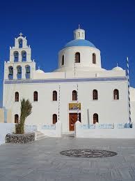
013-CHURCH OF PANAGIA –It is located at Oia Caldera Square, and approached from the bus station through a narrow rising pedestrian street and, from here Sunset can be viewed.
MYKONOS CITY (MYKONOS ISLAND-GREECE)
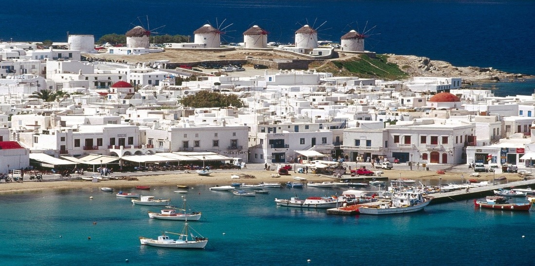
GENERAL INFORMATION-The island of Mykonos is one of the most popular Greek islands and it belongs to the Cyclades islands group. Mykonos Island, is the Ibiza of Greece as it is called, which looks just like the postcards, white little houses with flowers and blue windows and doors, hand painted streets, windmills, pigeon keepers, chimneys, lots of little churches and wonderful restaurants and cafes. A dry, arid island as the island is composed mostly of granite and the terrain is very rocky. It is in an area of 85.50 square kilometres with a population of 11,000 people and it is situated in the middle of the Aegean, and about 150kms from Piraeus port. The main town is a characteristic sample of Cycladic architecture, with whitewashed sugar houses, lovely churches and cobbled streets. Every house is reached via a flight of straight steps, parallel to the road, whilst the space underneath these steps was traditionally kept for storage. Atop the steps is a wooden painted balcony that sometimes projects over the road to nearly touch the balcony of the house across the street. Here you will find a change from the ubiquitous blue and white decor of Greece. In Mykonos town the wooden structures of every house are painted in a rainbow colours, against the whitewashed walls and blue sky, the effect is absolutely delightful. On a hill above the town, there are traditional windmills, while the most beautiful quarter in Little Venice with restaurants and bars right by the sea. The most fabulous beaches are located on the southern side of Mykonos Island. Super Paradise, Paradise, Platis Gialos and Lia amaze visitors with the soft sand and the crystal water. Beach bars are open all day and attract many visitors for swimming, kitesurfing and other activities. The island is a paradise for water sport enthusiasts. It is only natural that the “Island of the Winds” attracts surfers and sailors from all over the world .There is a great choice of beaches for windsurfing, however, the most secluded ones are considered to be the best. Choose from Kórfos, Fteliá, Meyáli Ámmos and Kalafátis, where surfing lessons are also available. Play tennis or mini golf at Ayios Stéfanos, beach volleyball at Ayia Anna or try sea parachuting or jet skiing at Eliá or Kalafátis. Diving fans can do a little exciting exploration of the underwater magic of Mykonos. September is thought to be the best month for diving, as the water is warm and visibility is good down at the seabed. Mykonos is mostly known for its exciting nightlife. .In the evening, people head to the Town, where there are also many bars. The Night Life of Myconos is at the sea front of Little Venice the bars or restaurants that line-up here. A nice trip is a boat trip to Delos, a small island that is considered an open archaeological site. According to mythology, Delos is the island where god Apollo was born and this is why there is an entire sanctuary dedicated to this god. For food take some local Aegean specialties as Pepper flavoured Kopanistí, a soft cheese seasoned with pepper, is the island’s gastronomic trademark. Try it as a topping on a round rusk spread with grated tomato, a favourite local mezés (appetiser).There are two exceptionally good local pastries, “amigdalotá” (small round cakes with ground almond, rosewater and caster sugar) and honey pie.
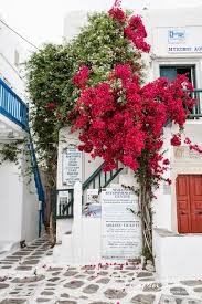
HISTORY- Mykonos the first known were the Ionians in the 9th century BC settled. During ancient times, Mykonos, due to its proximity to Delos (was highly populated) became very important as a supply island. The short 2-kilometer distance between the islands was frequently travelled, since religious rules specified that no one should be born or die on Delos. Around the time of Alexander the Great the island became a commercial centre for agriculture and maritime trade. In 1207, like the rest of the Cyclades, Mykonos came under Venetian rule which lasted until 1537, when the Turks dominated the islands along with the rest of Greece. The inhabitants were great sailors, so they provided important help to the Greek Revolution against the Turkish, in 1821. After the country's independence in 1830, the island's economy and commercial power were slowly but steadily re-established. In the period between World War I and II, visitors were attracted here mainly by the archaeological site of Delos. During the '50s, modern-day tourism started to grow, along with the island's population, but it was in the following two decades of the '60s and the '70s.
WEATHER- The sun shines for up to 300 hundred days a year and it is only every rainy between February and March. This arid climate means that there is very little natural vegetation. Although temperatures can rise as high as 40 degrees in the summer months, the wind prevents the overbearing heat and averages of 28 degrees are most common. Winters are very mild with average temperatures of 15 degrees.
WEATHER- The sun shines for up to 300 hundred days a year and it is only every rainy between February and March. This arid climate means that there is very little natural vegetation. Although temperatures can rise as high as 40 degrees in the summer months, the wind prevents the overbearing heat and averages of 28 degrees are most common. Winters are very mild with average temperatures of 15 degrees.
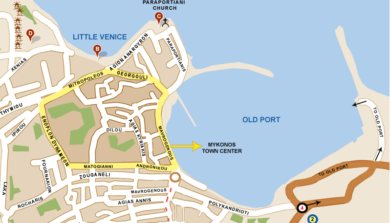
MYKONOS TOWN (CHORA) WALK- The heart of the city is closed to traffic during most of the day which make the walk among the labyrinth streets , especially during early morning when the city is calmer for most of the people are at the beaches or still sleeping after a long night of clubbing. The main town can be travelled all on foot because of the narrowness of the lanes. During evening hours the main roads into town are blocked off. Walk around, go to the windmills, feed the pelicans Petros, and visit the Parapotiani Church which has been recognized as a national cultural monument and is a superb representation of Cycladic architecture. There are five museums, an archaeological, a folk museum, a maritime, a cultural and a private one. Most of the museums of Mykonos are located at Enoplon Dynameon Street which is one of the busiest streets of Mykonos town during the summer. To reach this area is fairly straightforward. At the seafront, turn right by the Ferry Ticket Office into Matogianni Street, walk the length of this street and turn right at the end - this is Enopolon Dynameon Street. Here you will find the Aegean Maritime Museum (opening hours 10.30-13.00 pm and 18.30-21.00 pm), next to it is the Folk Museum, the House of Lena, (open 18.30-21.00 pm. Further down just before the 3 wells are the Churches of Saint George, which was built in the 15th century BC, and St Barbara and Saint Fanourios built in 1883.Behind the primary school of Mykonos is the main square of Chora "Laka", a green oasis in the whitewashed Mykonos town with Eucalyptus and Palm trees and all kinds of shops and eateries around, here also you will find the Post Office. Walking up from there to the west you will reach the plateau where the famous windmills are located. These are one of the most popular landmarks of Mykonos. In olden times the people from all over the Cyclades would bring their wheat and barley to these mills to be made into flour. Just beneath the windmills is the area of Alefkandra, or 'little Venice'. Its original name Alefkandra derives from its original use as a laundry and it was here that the women of Mykonos washed their clothes.
If you keep on walking through the winding small streets of Little Venice towards to the north, soon you will find the Paraportiani Church another famous landmark of Mykonos. The Paraportiani Church in fact is 5 churches all built in a compact complex. It is one of the most photographed buildings of Mykonos and an amazing combination of white against the blue of the sky and the sea. From Paraportiani, the Kastro (Castle Area) and the western part of the promenade are very close. In this area is the Municipality Building (City Hall) with its red clay roof. From this location the visitor can enjoy a panorama of the promenade of Mykonos. On the other side of the promenade at the taxi station in Manto Square is the Statue of Manto Mavrogenous a Myconian Heroic figure of the Greek War of Independence.
If you keep on walking through the winding small streets of Little Venice towards to the north, soon you will find the Paraportiani Church another famous landmark of Mykonos. The Paraportiani Church in fact is 5 churches all built in a compact complex. It is one of the most photographed buildings of Mykonos and an amazing combination of white against the blue of the sky and the sea. From Paraportiani, the Kastro (Castle Area) and the western part of the promenade are very close. In this area is the Municipality Building (City Hall) with its red clay roof. From this location the visitor can enjoy a panorama of the promenade of Mykonos. On the other side of the promenade at the taxi station in Manto Square is the Statue of Manto Mavrogenous a Myconian Heroic figure of the Greek War of Independence.
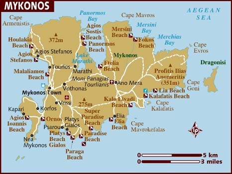
BEACHES-Mykonos is world famous for its beautiful golden sandy beaches and transparent waters. There is a beach for every taste and mood. Nudists, round-the-clock party people, families and those seeking a break from the madness of Mykonos will all be able to find a beach that fits their taste. The beaches on the south shore of the island have the best sand, view and are protected from the Meltemi, the local Cycladic wind. The north coast beaches are less developed but just as beautiful. They are less organized and crowded and most suitable for those in search of a bit of calm.
SIGHTS & ATTRACTIONS AT MYCONOS-

001-MYKONOS ARCHAEOLOGICAL MUSEUM-The Archaeological Museum of Mykonos was built in 1902, in order to house the finds from the "Purification Pit" of 426/5 B.C., which was discovered in 1898 on the islet of Rhenia. The exhibition of the museum includes a large number of vases, ranging from the prehistoric to the late Hellenistic period (25th-1st century B.C.), grave statues, and funerary urns from Rhenia, and very few finds from Mykonos.

002- AEGEAN MARITIME MUSEUM- It is housed in a traditional Mykonian building of the 19th century located at the centre of the Town of Mykonos, in the area known as Tria Pigadia. The building was the home of the legendary Master of the merchant ship "Enosis", Nikolaos Sourmelis, who assisted the Cretans during their war of independence from the Ottoman Empire.

003-DELOS ARCHAEOLOGICAL MUSEUM-Delos Museum was built in 1904 by the Archaeological Society at Athens and originally consisted of the five western rooms. It was enlarged in 1931 and 1972 and in the same period, the exterior of the building underwent great, but unfortunate, alterations. The present exhibition is arranged in nine rooms.
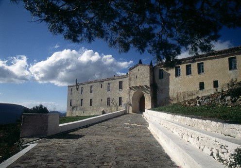
004-MYKONOS FOLKLORE MUSEUM-This museum is housed in an 18th century captain’s house, features a large collection of furnishing, including old musical instruments.
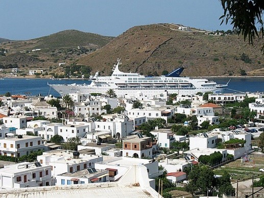
005-PANAGIA PARAPORTIANI- Panagia Paraportiani (Our Lady of the Side Gate) is the symbol of Mykonos located in the neighbourhood of Kastro or castle area, located at the entrance of the harbour. The church actually consists of five other churches built in 17th century and the 5th one is on upper storey reached by a staircase. It is the most photographed church in Mykonos, famous for its unusual shape and architecture. The four different architectural styles mixing Byzantine, vernacular, traditional and western style. Building of great Architectural value, it consists of 4 ground floor temples and one of the first floor, which is the main church. The churches around it (Aghios Sozontas, Aghii Anargyri, Aghia Anastasia, and Aghios Efstathios) comprise the whole of the church of Paraportiani.
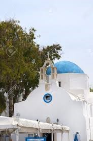
006- CATHOLIC CHURCH OF PANAGIA RODARIO - The Catholic Church of Panagia Rodario is located in Alefkandra Square (Little Venice), close to the windmills above Chora Town. This is the only catholic church on Mykonos and serves the Catholics that live permanently on the island and the thousands of foreign tourists that visit Mykonos every summer. Constructed in 1668, the church was renovated in 1677. The icon over the Holy Table presents Virgin Mary and baby Jesus between Saint Domenicus and Saint Catherine of Sienna. This icon was transferred to Mykonos from Venice in 1715. This is when the floor of the church was covered with marble and a gold-platted arch was put around the icon, after a donation of a local woman, Maroussa Vitali.
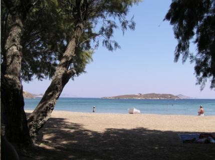
007-AGIA KYRIAKI-This church is situated in Agia Kyriaki Square, also the location of the Public Library, just a few metres inland is the comparatively large Agia Kyriaki Church. Its tall, white walls overshadow the little shops and clubs that line the charming square. The church holds regular services throughout the year.

008-MYKONOS WINDMILLS- They are primarily concentrated in the neighbourhood of Chora. These innovative wheels were primarily used for crushing agricultural yields. In all there were 16 such windmills in operation. They are conspicuous by their snow-white colour, spherical shape with the customary pointed roof made of the finest variety of wood. In the good old days, they were wind operated as Mykonos is renowned for their gusty wind, which continues to blow even today. As of now, the windmills are no longer operational. But they continue to be a symbol of Mykonos rich past. Being hundreds of years old, most of the windmills have been thoroughly renovated and some have even been converted into museums, the most famous being the Bonis Windmill. Mykonos windmills are a living testimony of the island's use of innovation.

009-MYKONOS TOWN HALL- The Town Hall is an elegant, two-storied building constructed in 1780AD. Next to it, the frugal and imposing building of MAVROU "Black" existed the first public school of Mykonos .The building was linked with the small temple of Saint Nikolaos of Kadenas that was found on islet with a bridge. The temple of Saint Nikolaos of Kadenas was found in this place at least from 1700, while the islet protector of harbour from the winds exists in the all naval maps from the 15th century. Here exists also the old school of Mavrou-"Black”. These two buildings are very important.

010-LITTLE VENICE (Alefkandra) - Little Venice is one of the most romantic places in the whole of Mykonos. This neighbourhood is replete with elegant and gorgeous old houses that are situated precariously on the edge of the sea. Quite amazing are the sunset views from Little Venice. Its whitewashed edifices against the backdrop of the azure blue Aegean Sea is simply marvellous. No wonder, Little Venice is today among the most photographed tourist neighbourhood in the whole of Europe. There are plenty of entertainment options ranging from pulsating discotheques to well-stocked bars. In the days of yore, many distinguished sailors had built their houses right on the picturesque shoreline. Many of these houses have today been converted into chic bars which are still very conspicuous by their old world charm.

011-PETER THE PELICAN- The Pelican called Petros (Peter) is an integral part of the island of Mykonos and it has become the mascot of the island. You can get a glimpse of the cute creature as it strolls leisurely in own unhurried pace through the city's many alleyways. Although it is particularly fond of the harbour area .Petros the Pelican has been officially declared as the mascot of Mykonos. He has made Mykonos his home since 1954. It took a person of the stature of Jackie Kennedy-Onassis to come to the rescue of Mykonos grieving populace and the compassionate Jackie Kennedy-Onassis rightfully donated another pelican to the island, Irene. It is said that the Hamburg Zoo had also donated a pelican named Petros. A few years back, there was an instance of another injured Pelican found in Mykonos by the local people who nursed it back to normal. They named the Pelican Nikolas. Now, in Mykonos, there are three Pelicans that can be seen wandering about Mykonos harbour.

012-THE MYKONIAN LIGHTHOUSE-It is called Armenistis is worth visiting cause the scenery around it. From there you may see all the boats arriving and departing Mykonos .Tinos Island looks like it is next to you from there.The lighthouse Armenistis is at the northeast of the island and 7 km away from Mykonos Town .You can get there by following the sings to Fanari. This lighthouse (Armenistis) was constructed in 1891. The altitude of tower is 19 metres and the height of focal plane is 184 metres.
The access to the lighthouse becomes by road from Saint Stefanos. The mechanism of first lamp of "Armenistis" is exposed outside by the building of Aegean Naval Museum that is located in a traditional building of 19th century, in centre of Mykonos, near to place Three Wells (Tria Pigadia).
The access to the lighthouse becomes by road from Saint Stefanos. The mechanism of first lamp of "Armenistis" is exposed outside by the building of Aegean Naval Museum that is located in a traditional building of 19th century, in centre of Mykonos, near to place Three Wells (Tria Pigadia).

013- MANTO MAVROGENOUS SQUARE- The square where the taxi stand is located takes its name from the Greek war heroine, Manto Mavrogenous and her statue sits in the middle. It is near to Thinking of Mykonos, Souvenir Store, Mavrogenous Street. Manto Mavrogenous (1796-1848) was a Greek war heroine. She played a significant role in the Greek War of Independence (1821-1832), where Greek revolutionaries fought against the Ottoman Empire. A wealthy woman of aristocratic lineage, she spent her entire fortune on supporting the Greek cause, also encouraging her European friends to donate money and guns.

014- THREE WELLS (Tria Pigadia) -Three identical wells sit in a row outside the famous Astra Bar. Unlike most modern wells which are 30 plus metres deep, the Tria Pigadia are only five to six metres deep as they were built into sand where water was more easily accessible. It is near The Agean Maritime Museum.
Many legends surround the Tria Pigadia. One has it that if a virgin drinks from all three wells she will be sure to find a husband. Another story says that if a man drinks from them he will marry a Mykonian woman. Whatever their alleged mystical powers, the wells were built in 1722 to provide Chora with water.
Many legends surround the Tria Pigadia. One has it that if a virgin drinks from all three wells she will be sure to find a husband. Another story says that if a man drinks from them he will marry a Mykonian woman. Whatever their alleged mystical powers, the wells were built in 1722 to provide Chora with water.

015- PILLARS IN GIALOS-In the old port sit four traditional free-sanding pillars next to the only beach in Chora
They are outside what is now a hotel - the first hotel on the island - but what used to be, together with the two neighbouring buildings, a private residence built in 1860. The 150-year-old pillars once supported a balcony on the first of the three houses. When the buildings were renovated 80 years ago, the pillars were placed in the current location rather than in a museum so that they could be accessed more easily by visitors.
They are outside what is now a hotel - the first hotel on the island - but what used to be, together with the two neighbouring buildings, a private residence built in 1860. The 150-year-old pillars once supported a balcony on the first of the three houses. When the buildings were renovated 80 years ago, the pillars were placed in the current location rather than in a museum so that they could be accessed more easily by visitors.

016- SUPER PARADISE (PLINTRI) - Just as famous as its neighbouring Paradise. Despite the paradisiacal setting, music blares from huge loud speakers and the beach partying often continues all day long. Full nudity is permitted on the right side of the beach which is also gay friendly. It is 7kms south east of Chora. It is reachable by local bus and small boat. Getting to Super Paradise Beach is an interesting drive through the country roads of Mykonos with its rocky, boulder-strewn landscape. From the main road there are two roads leading down to the beach by car. On reaching the junction, a left turn leads to the end of the beach with the refreshment facilities whereas a right turn leads down to the nudist area. Both roads have good, free parking areas with steps down to the beach. Alternatively, there are boat trips from Platis Gialos to Super Paradise Beach.

017- PARADISE (KALAMOPODI) –This beach is mainly for the young ones and love loud music. One of the most famous, nudist friendly, attracting young crowds by its 24 hour music and its day and night beach parties. Topless swimming is very common and since Paradise was the original nude beach of the island, it still attracts many nudists. Water sports, a diving centre and beach bars are available. Here the largest organised camping resides on the island, next to the after club Cavo Paradiso. It is 6kms from Chora on the south east direction and lies between Paranga and Super Paradise, is also reachable by a footpath from Platis Gialos, by bus or small boat.
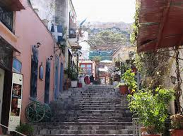
018- PLATIS GIALOS- About 4 km from Mykonos town, a very popular beach on the south side. It is also one of the longest on Mykonos. It was once a family beach, but nowadays it’s becoming more cosmopolitan. From here one may hire a small boat to visit other beaches like Paradise, Super Paradise etc. That was the only way to visit those beaches before roads were built. Good connection by bus with Mykonos town, till very late at night.

019- LIA AMAZE (14kms from Chora and in south east) - The farthest beach from Chora, of sand and pebbles. Since access is limited to private vehicle or taxi, this beautiful beach is suitable for those who avoid crowds.

020- MEGALI AMMOS-The closest beach to Chora, reachable by a 15 min walk, ideal for those who only have a few hours to spend.

021-PARAGA-Paraga beach isn't a very crowded beach and it is the first of the southern beaches which is tolerant to nude sunbathing and supports the needs of the young and fashionable. The landscape that surrounds it is very picturesque and there are also restaurants and music beach bars that help to the creation of a holiday atmosphere not only for its daily visitors but for those who chose to stay in its hotels and well organized camping facilities as well. There is a public bus service that will take you to Paraga as well as a frequent boat service from Platis Yialos beach.
